place

Saint Mary's College High School

1863 establishments in CaliforniaAlbany, CaliforniaAll pages needing cleanupCatholic secondary schools in CaliforniaEducation in Berkeley, California
Educational institutions established in 1863High schools in Alameda County, CaliforniaLasallian schools in the United States
Saint Marys College HS

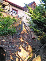
Saint Mary's College High School is a coeducational Catholic school located in Berkeley, California, United States. It came into being as part of Saint Mary's College of California, founded in 1863 by the Catholic Church, and put under the auspices of the Institute of the Brothers of the Christian Schools in 1868.

Excerpt from the Wikipedia article Saint Mary's College High School (License: CC BY-SA 3.0, Authors, Images).

Saint Mary's College High School
Ventura Avenue, Berkeley

Geographical coordinates (GPS) Address External links Nearby Places
placeShow on map

Wikipedia: Saint Mary's College High SchoolContinue reading on Wikipedia

Geographical coordinates (GPS)

Latitude Longitude
N 37.8835 ° E -122.2838 °
placeShow on map

Address

Saint Mary's College High School

Ventura Avenue
94702 Berkeley
California, United States
mapOpen on Google Maps

linkWikiData (Q7401828)
linkOpenStreetMap (35602477)

Saint Marys College HS
Share experience

Nearby Places

Westbrae, Berkeley, California

Westbrae is a neighborhood in the northern part of Berkeley, California in the East Bay section of the San Francisco Bay Area. Westbrae is "centered" on the intersection of Santa Fe Avenue and Gilman Street, although the main extent is east, south and west of this intersection, with the Albany city limit only a short distance north. It lies at an elevation of 79 feet (24 m). The neighborhood is mainly residential, with a small commercial section along Gilman from Santa Fe to Tevlin Street. In the past, businesses consisted of liquor and grocery stores but now are small restaurants, a natural food store, bakeries, and a nursery. The elevated tracks of the BART Richmond line cut diagonally across Westbrae, crossing over Gilman in the commercial section. There is a church formerly named the Westbrae Bible Church, now the Evangel Bible Church of Berkeley, located nearby on the corner of Hopkins and Ordway about three blocks from the center of the Westbrae neighborhood. The current, most notable businesses are the Berkeley Natural Grocery Company, the Westbrae Biergarten, and Westbrae Nursery. Until about 1979, the tracks of the Santa Fe railroad ran beside where the BART elevated and underground lines are today. Today, the Ohlone Greenway, a bicycle and pedestrian path, follows the old right-of-way. Paralleling the Santa Fe tracks to the east were the tracks of the Key System's G-Westbrae line. The "G" terminated at a small station just short of the city limits at Codornices Creek. The origin of Westbrae is directly connected to the Key System. The Key System was part of a larger enterprise which included real estate, the Realty Syndicate. The name "Westbrae" was given by the Key developers and included tracts north of Codornices Creek in Albany. A street through the heart of this area was, and remains, "Key Route Boulevard". There were future plans to extend the G-Westbrae line northward to serve the development area, but this never happened. The "G" remained a trolley shuttle between the terminal near Gilman and Santa Fe, connecting with the H transbay line at Sacramento Street and University Avenue instead of being extended and transformed into a full-fledged transbay line of its own. AC Transit operates a Transbay express bus line along Key Route designated G, and also an H line to this day; the designations are inherited from the Key System lines.

Thousand Oaks, Berkeley, California

Thousand Oaks is a neighborhood of Berkeley in Alameda County, California. Located at the base of the Berkeley Hills, it lies at an elevation of 239 feet (73 m).The principal shopping area is Solano Avenue, along the southern edge of the neighborhood. There are also two smaller clusters of shops on the northern edge of Thousand Oaks, across the county line in Kensington on Arlington Avenue and on Colusa Avenue. The neighborhood is primarily residential, mostly consisting of single-family houses built in the early 20th century, sometimes with In-law apartments, as well as a handful of apartment buildings. When the neighboring city of Albany was incorporated in 1908, its borders were drawn to exclude the area north of Solano Avenue and east of Curtis Street that would become the Thousand Oaks area, then the site of a refugee camp that had formed after the 1906 earthquake. Its residents were employed in the construction of the surrounding subdivisions and were likely to vote against incorporation as a separate city. The neighborhood was first subdivided in 1909 and 1917 after a failed proposal to move the state capital to Berkeley, in which the area would have become a large public park near the capitol building. Originally an unincorporated area north of Berkeley, it was built as a commuter suburb at the northern terminus of three interurban rail lines. It includes the Thousand Oaks Knoll, a rocky extension of the Berkeley hills in the northeastern part of the neighborhood. Several large rock outcroppings in the eastern edge of the neighborhood were turned into public parks, or incorporated into private yards.

Northbrae Tunnel
Northbrae Tunnel

The Northbrae Tunnel, also referred to as the Solano Avenue Tunnel, was built as a commuter electric railroad tunnel in the northern part of Berkeley, California, and was later converted to street use. In 1910 the Southern Pacific Railroad (SP) was electrifying its steam-engine drawn ferry-train line (to San Francisco) from Oakland Pier via Shattuck Avenue to Vine Street in Berkeley and extending it north along the base of the Berkeley Hills to newly developing neighborhoods of Berkeley at Northbrae and Thousand Oaks. The route chosen was Henry Street and Sutter Street to its intersection with Hopkins. At this point a ridge carrying Marin and Los Angeles Avenues blocked the way. After investigating (1) a route around the ridge and (2) a cut through the ridge with bridges over it, it was decided to use the route of the cut but make it a tunnel instead, under Marin and Los Angeles Avenues just west of their intersection with The (Marin) Circle. The cut-and-cover method of tunnel construction was used. The tunnel curved to the west so that the railroad could continue through to the intersection of Solano Avenue and The Alameda and then to Thousand Oaks station at Solano and Colusa Avenues.The line also required a level grade across the lower canyon of Codornices Creek. To accomplish this, a temporary wooden trestle was built along Henry Street with tracks for the construction trains which was subsequently filled in with material excavated from the tunnel cut. A steel bridge was emplaced at Eunice Street. allowing auto traffic to pass under the tracks. The railroad was completed in 1911 and inspection trains were run at the end of that year, with service beginning January 1, 1912. The SP ferry-train service was changed to bridge-train service operated by its subsidiary, Interurban Electric Railway (IER) across the San Francisco Oakland Bay Bridge in December, 1939. The IER ended service July 26, 1941, but the tracks in Berkeley were made available to the Key System, which extended service to Hopkins and Sutter Streets (the stop formerly called Northbrae) beginning August 6, 1941. Service was extended through the tunnel to a new terminal at Solano Avenue and The Alameda on December 6, 1942. All bridge-train service ended on April 20, 1958.A paved roadway was installed in the tunnel by the City of Berkeley, and was opened to traffic on December 15, 1962, extending Solano Avenue through the tunnel to connect with Sutter Street.