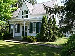
Fruitland, Ontario
Golden Horseshoe geography stubsNeighbourhoods in Hamilton, OntarioUse Canadian English from January 2023
Fruitland, Ontario (Census Tract 5370085.03) (2006 Population 2,824) is a community in the eastern end of Hamilton, Ontario, Canada. Its adjacent communities includes Winona, Beamsville, and Grimsby. The region became known as Fruitland due to its fertile soil, and the region is renowned for its winery industry. At the eastern border is Glover Road and its western border is Millen Road. E. D. Smith's Jam and Condiment Factory is located just to the east of Fruitland, as well as many other industrial entities. Orchards are also in abundance, and the region attracts many migrant workers who work in the fields.
Excerpt from the Wikipedia article Fruitland, Ontario (License: CC BY-SA 3.0, Authors).Fruitland, Ontario
Dewitt Road, Hamilton
Geographical coordinates (GPS) Address Nearby Places Show on map
Geographical coordinates (GPS)
| Latitude | Longitude |
|---|---|
| N 43.21 ° | E -79.7151 ° |
Address
Dewitt Road 43
L8G 1G4 Hamilton
Ontario, Canada
Open on Google Maps


