place

North Branch Pawtuxet River

Northeastern United States river stubsRhode Island geography stubsRivers of Kent County, Rhode IslandRivers of Providence County, Rhode IslandRivers of Rhode Island
Tributaries of Providence River
Pawtuxet Harris
Pawtuxet Harris

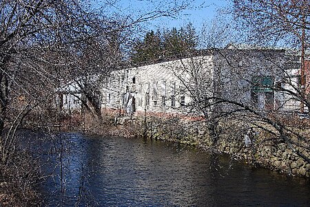
The North Branch Pawtuxet River is a river in the U.S. state of Rhode Island. It flows approximately 8.9 miles (14.3 km). There are 9 dams along the river's length.

Excerpt from the Wikipedia article North Branch Pawtuxet River (License: CC BY-SA 3.0, Authors, Images).

North Branch Pawtuxet River
Scituate Avenue,

Geographical coordinates (GPS) Address Nearby Places
placeShow on map

Wikipedia: North Branch Pawtuxet RiverContinue reading on Wikipedia

Geographical coordinates (GPS)

Latitude Longitude
N 41.7505 ° E -71.5855 °
placeShow on map

Address

Scituate Avenue

Scituate Avenue
02831
Rhode Island, United States
mapOpen on Google Maps

Pawtuxet Harris
Pawtuxet Harris
Share experience

Nearby Places

Arkwright, Rhode Island

Arkwright is a village in the northeastern corner of Coventry, Rhode Island touching Cranston and Scituate, now connected by Route 115. In the 1700s the Remington family owned a large parcel of land in the area, and the village became known as "Remington’s Run." In the early nineteenth century, the area was known as "Burlingame Mills" after the saw mill and grist mill run by Jabez and James Burlingame. In April 1809 the Burlingames, Elisha Arnold, and Nathan Potter sold the land to the Arkwright Manufacturing Company, which was owned by James DeWolf, a slave trader, estimated to have financed nearly 30 slaving voyages and transported 11,000 Africans to the United States; Doctor Caleb Fiske, Philip Fiske, and Asher Robbins. The company was named after Richard Arkwright, a British mill entrepreneur who had trained Samuel Slater. Arkwright Manufacturing constructed its first textile mill in 1810. After a fire it was rebuilt in 1822, with various buildings being added later in the nineteenth and twentieth century. It was the beginning of the textile industry in New England, leading to strong economic ties with the Deep South, whose slave labor supplied the cotton. The mill passed through various owners. In 1883 it was sold and organized as the Arkwright–Interlaken Company to produce book cloth. The mill and various related buildings still survive today in the village; the mill is the last to operate in the villages of Coventry.

Arkwright Bridge
Arkwright Bridge

The Arkwright Bridge is an abandoned historic bridge formerly carrying Hill Street over the Pawtuxet River in the Arkwright mill village in central Rhode Island. The river forms the border between Cranston and Coventry. The first bridge to span the Pawtuxet River at this location was an early nineteenth century wooden bridge, located in the city of Cranston. In 1887, a special resolution was passed changing the Coventry-Cranston border to the Pawtuxet River. A new iron bridge was commissioned in 1888 by a joint building committee from both Coventry and Cranston and the responsibility for maintenance of the new bridge was to be shared by both municipalities.The bridge was built in 1888 by Dean & Westbrook for the Town of Coventry and the Interlaken Mills (later known as the Arkwright Mills). It is the longest surviving 19th century truss bridge in Rhode Island, and was added to the National Register of Historic Places in 1978. The bridge is 128 feet, 6 inches long; 19 feet, 7 inches wide; and has and a depth of truss of 21 feet. The bridge is a single-span, through Pratt truss, built using Phoenix columns. In 2004, there was a proposal to move the Arkwright Bridge to another location along the Pawtuxet River along the border of West Warwick, Rhode Island to be part of a proposed West Warwick Riverwalk. The bridge was ultimately not moved.The Rhode Island Department of Transportation recommended closure of the locally owned bridge, and following an inspection, determined that the weight limit should be reduced to less than 3 tons from the previous 5 tons. Both communities closed the 123-year-old span on Friday, September 30, 2011. The bridge continues to be a popular jumping and swimming spot for local youth, with approximately 12 feet of air and an average 15 feet of water. The bridge was closed to pedestrians in 2019 after the death of a local youth who was diving off the bridge with friends.