place

Goodwood Road, Hobart

1984 establishments in AustraliaAustralia road stubsGlenorchy, TasmaniaStreets in HobartUse Australian English from March 2018
Goodwood Road traffic lights fcing west

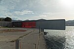
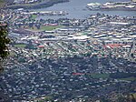
Goodwood Road is a 4-lane link road that connects the City of Glenorchy to the City of Clarence in the greater area of Hobart, Tasmania. Using the Bowen Bridge the road travels over the River Derwent in semi-highway road layout. The Road starts 10 km north of the Hobart CBD near the Hobart Showground on the Brooker Highway at Glenorchy, from there it travels east past the Elwick Racecourse, over the Bowen Bridge and connects to the East Derwent Highway at Otago. While the route the road takes is used far less than other major arterial roads in Hobart, commuters often depend on the road when major incidents occur on other major roads throughout Hobart. The Wilkinsons Point and Elwick Bay master plan indicates plans to upgrade the traffic lights at Loyd Road to a roundabout to improve the overall traffic flow of Loyd Road.The Tasmanian Department of Infrastructure, Energy and Resources proposes to re-align Goodwood Road with Elwick Road, reducing confusion and the number of traffic lights on the Brooker Highway.

Excerpt from the Wikipedia article Goodwood Road, Hobart (License: CC BY-SA 3.0, Authors, Images).

Goodwood Road, Hobart
Goodwood Road, Hobart Dowsing Point

Geographical coordinates (GPS) Address Nearby Places
placeShow on map

Wikipedia: Goodwood Road, HobartContinue reading on Wikipedia

Geographical coordinates (GPS)

Latitude Longitude
N -42.8216 ° E 147.3025 °
placeShow on map

Address

Goodwood Road

Goodwood Road
7009 Hobart, Dowsing Point
Tasmania, Australia
mapOpen on Google Maps

Goodwood Road traffic lights fcing west
Share experience

Nearby Places

Risdon Cove
Risdon Cove

Risdon Cove is a cove located on the east bank of the Derwent River, approximately 7 kilometres (4 mi) north of Hobart, Tasmania. It was the site of the first British settlement in Van Diemen's Land, now Tasmania, the island state of Australia. The cove was named by John Hayes, who mapped the river in the ship Duke of Clarence in 1794, after his second officer William Bellamy Risdon. In 1803 Lieutenant John Bowen was sent to establish a settlement in Van Diemen's Land. On the advice of the explorer George Bass he had chosen Risdon Cove. While the site was a good one from a defensive point of view, the soil was poor and water scarce. Lady Nelson anchored at Risdon on the eastern shore of the Derwent River on Wednesday 8 September 1803, five days before the whaler Albion arrived with Lt. Bowen on board. The 49 people aboard the Lady Nelson and Albion made a curious party of soldiers, sailors, settlers and convicts. In 1804 Lieutenant Colonel David Collins arrived in the Derwent from Port Phillip on Ocean. Within a few days he rejected Risdon Cove as a suitable settlement site, for its inadequate source of fresh water, and moved his party across the river to Sullivans Cove. The military and convicts disembarked from Ocean near Hunter Island on 20–21 February 1804 and thus beginning what is now Hobart. Lady Nelson landed the free settlers at New Town Bay on 22 February. One of the first land grants at Risdon Cove was made to Dr William F A I'Anson, the chief surgeon who arrived with Lieutenant-Governor Collins in 1804.