Stöckey
Eichsfeld district geography stubsFormer municipalities in ThuringiaSonnenstein, Thuringia

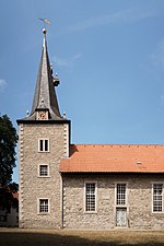
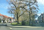
Stöckey is a village and a former municipality in the district of Eichsfeld in Thuringia, Germany. Since 1 December 2011, it is part of the municipality Sonnenstein, of which it is an Ortschaft.
Excerpt from the Wikipedia article Stöckey (License: CC BY-SA 3.0, Authors, Images).Stöckey
Schulstraße, Sonnenstein
Geographical coordinates (GPS) Address Nearby Places Show on map
Geographical coordinates (GPS)
| Latitude | Longitude |
|---|---|
| N 51.533888888889 ° | E 10.502777777778 ° |
Address
Schulstraße
Schulstraße
37345 Sonnenstein (Stöckey)
Thuringia, Germany
Open on Google Maps


