place

Bischofsmais

Lower Bavaria geography stubsMunicipalities in BavariaRegen (district)
Bischofsmais1
Bischofsmais1

Bischofsmais is a municipality in the district of Regen, in Bavaria, Germany. It is well known for winter sports, especially cross-country skiing.

Excerpt from the Wikipedia article Bischofsmais (License: CC BY-SA 3.0, Authors, Images).

Bischofsmais
Hauptstraße,

Geographical coordinates (GPS) Address Nearby Places
placeShow on map

Wikipedia: BischofsmaisContinue reading on Wikipedia

Geographical coordinates (GPS)

Latitude Longitude
N 48.916666666667 ° E 13.083333333333 °
placeShow on map

Address

Sparkasse Bischofsmais

Hauptstraße 5
94253
Bavaria, Germany
mapOpen on Google Maps

Bischofsmais1
Bischofsmais1
Share experience

Nearby Places

Einödriegel
Einödriegel

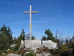
The Einödriegel is a mountain, 1,120.6 m above sea level (NHN), in the Bavarian Forest in Germany. It rises southwest of the Lower Bavarian county town of Regen and northeast of the county town of Deggendorf. It is the highest point in the Danube Hills and the county of Deggendorf and lies in the municipality of Grafling. Neighbouring mountains are the Geißkopf, the Dreitannenriegel and the Breitenauriegel, which all lie along the same ridge near Bischofsmais. The Einödriegel has good views from the top to the west and northeast and an imposing summit cross with rest benches. In the winter a ski lift runs up the mountain from the Unterbreitenau, which is part of the Geißkopf ski area. The top may be reached on foot on a waymarked footpath. The summit cross does not stand on the highest point of the mountain. The latter is just under 100 metres south of the cross immediately next to the trail on a small rock group which is surrounded by trees and has no views. According especially to older geographical and lexical works, the mountains of the Hinterer Forest ( the Arber, Rachel, Lusen and others) are already counted as part of the Bohemian Forest, so based on that definition the Einödriegel would be the highest peak in the Bavarian Forest. Even in 1982 the Brockhaus wrote in an article entitled Bayerischer Wald that: "in a geographical sense the Bavarian Forest is that part of the Bohemian Forest that rises as the Vorderer Wald (Danube Hills) between the rivers Danube and Regen (at the Einödriegel to 1,121 m)".

Lallinger Winkel
Lallinger Winkel

The Lallinger Winkel is a high valley, 162 km² in area, named after the village of Lalling, in the county of Deggendorf in the Bavarian Forest, Germany. The region opens into the Danube plain to the southeast but is delimited to the northwest, north and east by the mountain ridges of the Danube Hills which keep at bay the cold winds and rain. Apart from Lalling, the Lallinger Winkel also extends into the municipalities of Schaufling and Hunding. In the south near Auerbach the Lallinger Winkel is adjoined by the Hengersberg-Schwanenkirchen Tertiary Bay. From a geological view, the region is a section of the southern Bohemian Massif. Its rocks include various gneisses and granites. The region around Lalling was developed as early as the foundation phase of Niederaltaich Abbey in the 8th century. During the 150-year initial period of clearances, many villages were built in the Lallinger Winkel. The abbey used the favourable climatic conditions for orchards and encouraged the settlers to grow apples, pears and peaches. From 1861 to 1904 Lalling was the centre of a district fruit nursery. Even today the Lallinger Winkel is characterised by orchards and is called the 'fruit basket of the Bavarian Forest' (Obstschüssel des Bayerischen Waldes). Many small villages grow the traditional scattered orchards (Streuobstwiesen). The initiative Scattered Orchards Beyond the Year 2000 (Streuobstanbau über das Jahr 2000) led to new plantings of thousands of standard fruit trees and the establishment of the freely accessible scattered orchard experience garden in Panholling, Hunding. Especially when the trees are in bloom or at harvest time, the orchards in the Lallinger Winkel are important for tourism. Also well known are the Lallingen snowdrop meadows (Lallinger Schneeglöckerlwiese) and spring snowflakes.