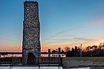
Navy Island

Navy Island is a small, uninhabited island in the Niagara River in the province of Ontario, managed by Parks Canada as a National Historic Site of Canada. It is located about 4.5 kilometres (2+3⁄4 miles) upstream from Horseshoe Falls, and has an area of roughly 1.2 km2 (7⁄16 sq mi). It is across from the town of Grand Island, New York, US. It was designated a national historic site in 1921 in recognition of its role in shipbuilding and the location of the short-lived Republic of Canada.[1] The island is the only island in the Niagara River located within Canadian territory and is the second largest Island in the Niagara River. The site is closed to the public, has no visitor facilities, and has not allowed camping since the expiration of a lease with the Niagara Parks Commission.[2]
Excerpt from the Wikipedia article Navy Island (License: CC BY-SA 3.0, Authors, Images).Navy Island
Niagara Falls
Geographical coordinates (GPS) Address Website Nearby Places Show on map
Geographical coordinates (GPS)
| Latitude | Longitude |
|---|---|
| N 43.056 ° | E -79.01 ° |
Address
Niagara Falls
Niagara Falls
Ontario, Canada
Open on Google Maps


