place

ANT Coos Bay

1976 establishments in OregonBuildings and structures in Coos County, OregonMilitary installations in OregonOregon CoastOregon government stubs
United States Coast Guard stationsUnited States Coast Guard stubs
Ant air
Ant air

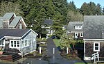
The United States Coast Guard Aids To Navigation Team, ANT Coos Bay was established in 1976 and is located near the mouth of Coos Bay in the fishing and tourist community of Charleston, Oregon, southwest of the city of Coos Bay. ANT Coos Bay's area of responsibility ranges over 240 miles of the Oregon coast and includes 3 lighthouses, 18 primary buoys, 43 secondary buoys and 156 other lights, day beacons and fog signals.The assigned crew of seven consists of an Officer In Charge (Chief Boatswain's Mate), Executive Petty Officer (Boatswain's Mate First Class), Engineering Petty Officer (Machinery Technician First Class), Operations Petty Officer (Boatswain's Mate Second Class), one Lighthouse Technician (Electrician's Mate Second Class), one Fireman, and one Seaman. ANT Coos Bay utilizes a 17 ft utility boat (UTL) and a 26 ft work boat (TANB).

Excerpt from the Wikipedia article ANT Coos Bay (License: CC BY-SA 3.0, Authors, Images).

ANT Coos Bay
Kingfisher Road,

Geographical coordinates (GPS) Address Website Nearby Places
placeShow on map

Wikipedia: ANT Coos BayContinue reading on Wikipedia

Geographical coordinates (GPS)

Latitude Longitude
N 43.344166666667 ° E -124.325 °
placeShow on map

Address

Charleston Marina RV Park

Kingfisher Road 63402
97420
Oregon, United States
mapOpen on Google Maps

Website
portofcoosbay.com

linkVisit website

Ant air
Ant air
Share experience

Nearby Places

Camp Castaway

Camp Castaway was a military encampment at what is now Coos Bay, Oregon, United States. It was established by the survivors of the wreck of the Captain Lincoln, a U.S. transport schooner, on January 3, 1852. The ship began taking on water during a storm while en route from San Francisco to Fort Orford at the town of Port Orford. To avoid sinking, the captain decided to beach the ship north of Cape Arago. All of the roughly 30 troops (U.S. 1st Dragoons, Company C, predecessors to the U.S. Cavalry) on board, and the ship's crew, survived the wreck and most of the cargo was salvaged. At the time no U.S. settlement was present at Coos Bay, so commanding officer Lt. Henry Stanton decided to establish the camp to protect the cargo until it could be transported to Fort Orford, some 50 miles south on the Oregon Coast. The troops and crew used spars, booms and sail cloth from the schooner to build tent structures for housing and for protecting the cargo from winter rains and blowing sand. They named the temporary post Camp Castaway. The camp endured for four months in the open dunes with help from Native Americans of the Coos tribe who traded fresh foods to the soldiers for silverware, biscuits and other nonlocal goods.The archaeological remains of Camp Castaway were located by archaeologist Scott Byram during a survey in March, 2010, using 150-year-old archival records and maps he studied at the United States Coast Survey archives in Maryland. It was subsequently designated Oregon archaeological site 35CS277. The site is located on land administered by the Bureau of Land Management, Coos Bay District. Following discovery of the site, BLM archaeologist Steve Samuels assembled a team from Southern Oregon University Laboratory of Anthropology, the Confederated Tribes of Coos, Lower Umpqua and Siuslaw Indians, and the Coquille Indian Tribe to excavate the site. Lead archaeologist Mark Tveskov of SOU concluded that the site was Camp Castaway based on the distinctive artifacts recovered. NOAA archaeologists Robert Schwemmer and James Delgado and historian John Cloud are also research team members. A full report of these excavations was due for publication in fall 2014.