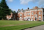
Waddington, Lancashire
Civil parishes in LancashireGeography of Ribble ValleyHistory of YorkshireUse British English from April 2015Villages in Lancashire

Waddington is a small village, 2 miles (3 km) north-west of Clitheroe in the Ribble Valley, Lancashire, England. The population of the civil parish at the 2011 census was 1,028. Before the 1974 county boundary changes, Waddington fell just within the Bowland Rural District of the West Riding of Yorkshire. It covers approximately 2000 acres of the Forest of Bowland.
Excerpt from the Wikipedia article Waddington, Lancashire (License: CC BY-SA 3.0, Authors, Images).Waddington, Lancashire
Pinder Close, Ribble Valley Waddington
Geographical coordinates (GPS) Address Nearby Places Show on map
Geographical coordinates (GPS)
| Latitude | Longitude |
|---|---|
| N 53.887 ° | E -2.417 ° |
Address
Pinder Close
BB7 3LF Ribble Valley, Waddington
England, United Kingdom
Open on Google Maps


