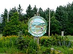
Gatineau Park

Gatineau Park (French: Parc de la Gatineau) is a federal park located in the Outaouais region of Quebec, Canada. Administered by the National Capital Commission as part of the National Capital Region, Gatineau Park is a 361 square kilometres (139 sq mi) wedge of land extending north and west from the city of Gatineau. With a perimeter of 179.2 kilometres (111.3 mi), the park includes parts of the municipalities of Chelsea, Pontiac, La Pêche, and the City of Gatineau. The main entrance to the park is 4 kilometres (2.5 mi) north of downtown Ottawa, Ontario. The park's area has a long history of human inhabitation and usage predating the arrival of European settlers. Its more recent pre-park history includes various forms of human exploitation such as farming, logging, hunting, and industrial activity. The idea of creating a park in the Gatineau Hills for recreational purposes was proposed as early as 1903. In 1938 money was allotted for the acquisition of Gatineau woodlands (for preservation) and the construction of a parkway. The Government of Canada maintains a conference centre at Meech Lake, known as Willson House, the site of meetings leading to a failed attempt to reform Canada's Constitution in 1987, the Meech Lake Accord. There are significant ongoing controversies about the administration of the park, including its status as the only federal park that is not part of the national parks system, the existence and construction of private residences inside it, residents' extensive violation of shoreline protection bylaws at Meech Lake, and changes to its boundaries without the knowledge of parliament. For instance, inspection reports carried out by the Municipality of Chelsea in 2013 and 2015 confirm that 119 structures have been built without permit at Meech Lake, and that 80% of Meech Lake residents whose properties were inspected continue to violate county bylaw MRC 137-09 several years after it was adopted.
Excerpt from the Wikipedia article Gatineau Park (License: CC BY-SA 3.0, Authors, Images).Gatineau Park
Trail #54, Pontiac
Geographical coordinates (GPS) Address Nearby Places Show on map
Geographical coordinates (GPS)
| Latitude | Longitude |
|---|---|
| N 45.583333333333 ° | E -76 ° |
Address
Trail #54
Trail #54
J0X 2G0 Pontiac
Quebec, Canada
Open on Google Maps


