Five Points, Manhattan

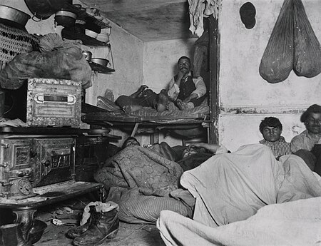
Five Points (or The Five Points) was a 19th-century neighborhood in Lower Manhattan, New York City. The neighborhood, partly built on land which had filled in the freshwater lake known as the Collect Pond, was generally defined as being bound by Centre Street to the west, the Bowery to the east, Canal Street to the north, and Park Row to the south. The Five Points gained international notoriety as a densely populated, disease-ridden, crime-infested slum that existed for over 70 years.Through the twentieth century, the former Five Points area was gradually redeveloped, with streets changed or closed. The area is now occupied by the Civic Center to the west and south, which includes major federal, state, and city facilities. To the east and north, the former Five Points neighborhood is now part of Manhattan's Chinatown.
Excerpt from the Wikipedia article Five Points, Manhattan (License: CC BY-SA 3.0, Authors, Images).Five Points, Manhattan
Mulberry Street, New York Manhattan
Geographical coordinates (GPS) Address Nearby Places Show on map
Geographical coordinates (GPS)
| Latitude | Longitude |
|---|---|
| N 40.714444444444 ° | E -74.000277777778 ° |
Address
Mulberry Street 30
10013 New York, Manhattan
New York, United States
Open on Google Maps


