place

Köpmanbrinken

Stockholm road stubsStreets in Stockholm
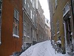
Kopmanbrinken March 2007

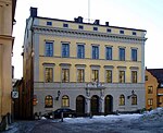
Köpmanbrinken (Swedish: "Merchant's Slope") is a street composed of two slopes, in Gamla stan, the old town in central Stockholm, Sweden. Both slopes connect the street Österlånggatan west up to the small Köpmantorget and the street Köpmangatan. Since the foundation of the city the slopes reflects the original inclination treadled by the city's first inhabitants.The northern slope was referred to as Fiskestrandsbrinken ("Fishing Shore Slope") during the Middle Ages, because the area east of the slopes, between the alleys Nygränd and Brunnsgränd, used to be the city's main fish market Fiskaretorget until 1520. The statue of St George and his princess is replica made in 1912 of the medieval original in the cathedral Storkyrkan.On the narrow space along the slopes' eastern sides, where the statue of Saint George and the Dragon is found today, there was an entire block called Acteon which was demolished following a collapse in 1829. The slopes were made less steep following the collapse. During the 19th century, the slopes were regarded as two individual streets, separated by the square Köpmantorget. The two streets were subsequently united as a single street with its present name in 1885.

Excerpt from the Wikipedia article Köpmanbrinken (License: CC BY-SA 3.0, Authors, Images).

Köpmanbrinken
Köpmanbrinken, Stockholm Gamla stan (Södermalms stadsdelsområde)

Geographical coordinates (GPS) Address External links Nearby Places
placeShow on map

Wikipedia: KöpmanbrinkenContinue reading on Wikipedia

Geographical coordinates (GPS)

Latitude Longitude
N 59.325277777778 ° E 18.073722222222 °
placeShow on map

Address

Köpmanbrinken

Köpmanbrinken
111 30 Stockholm, Gamla stan (Södermalms stadsdelsområde)
Sweden
mapOpen on Google Maps

linkWikiData (Q10552207)
linkOpenStreetMap (167356943)

Kopmanbrinken March 2007
Share experience

Nearby Places

Fisketorget

Fisketorget (Swedish: "Fishery Square") or Fiskaretorget ("Fishermen's Square") is a historical public square in Gamla stan, the old town in central Stockholm, Sweden. It was once located on the east shore of the island Stadsholmen, between the present streets Österlånggatan and Skeppsbron, and between the present alleys Nygränd ("New Alley") and Brunnsgränd ("Well's Alley"). As Stockholm grew rapidly during the 14th century, the city within the city walls became cramped for space, and the surrounding shores started to be built upon and subsequently by land fillings between the bridges extended into the water. Thus, elongated blocks appeared between narrow alleys along the eastern shore of the city, with the exception of the area outside the only eastern city gate — the so-called Köpmanporten ("Merchant's Gate") which extended Köpmangatan ("Merchant's Street) from the city's central square, Stortorget ("Large Square"), beyond the city wall over Köpmanbrinken. Originally, the marketplace was called Fiskestrand ("Fishery Shore") and also encompassed a section of the shoreline stretching north up to the present alley Skeppar Karls Gränd.From 1413, the square was probably flanked by two defensive towers, some major building featuring stepped gables, and several one-storey buildings. In 1461, a blacksmith named Henrik is mentioned as having forged on a water well on the square, at the time the biggest in Stockholm. The well eventually gave the southern alley its name and was still found in the alley until the 19th century. The square was, however, was started to be built upon during the early 1520s, which eventually led to the present block on the location, Diana, which still contains the well.

Peder Fredags Gränd
Peder Fredags Gränd

Peder Fredags Gränd is a small blind alley in Gamla stan, the old town in central Stockholm, Sweden. Stretching north from Köpmangatan, it is located between Skeppar Olofs Gränd and Staffan Sasses Gränd, just south of the Tessin Palace. The inconspicuous alley remained nameless until the 20th century; it is included on a map from 1700, but completely left out on another dated 1733. The present name was given to the alley in 1939, presumably inspired by the two parallel alleys, both of which are named after men who served King Gustav Vasa (1496–1560) during the ousting of Danish forces.Peder Fredag (–1525) was probably one of the burghers of Stockholm, who first appeared in historical records in 1520 when, confronted with Christian II of Denmark, he vehemently opposed the city's terms of surrender. Before the Danes marched into the city, he escaped to the north of Sweden where he began to amass people to revolt against the Danish king. He started to raid the Stockholm Archipelago with his yacht, and in 1521 he joined the party of Gustav Vasa who eventually gave him a letter of marque. During the seizure of the capital, Peder Fredag was appointed captain in charge of the camp at Lovön, and as such he repelled an attack from the besieged city during Christmas 1521 and another against the King's camp on Södermalm in autumn 1522. Following the king's glorious march into the city, Peder Fredag was richly rewarded with marks of honour and tokens of grace, but he eventually died on the battlefield in 1525 during an assault against the city of Kalmar, besieged by the mercenary troops of Berend von Melen.

Brända Tomten
Brända Tomten

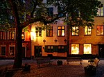
Brända Tomten (Swedish: The Burnt Lot) is a small, triangular public square in Gamla stan, the old town in central Stockholm, Sweden. A few benches under a chestnut tree, the ivy hanging from the surrounding façades makes the space a lush, relaxed spot. During summers, a network of storytellers gather around the benches to tell their stories both to enthusiasts and passers-by.A building located on in the corner between the streets Kindstugatan and Själagårdsgatan destroyed by fire in 1728, was apparently not rebuilt for a few decades, which gave first the lot and then the open space their names. The turning radius of horse-drawn vehicles made open spaces necessary, and the city architect Johan Eberhard Carlberg (1683–1773) in 1734 mentions having proposed a turning space on the location two years earlier, on a plan naming the space Eckmarcks afbrände tomt ("Ekmarck's burnt-out lot"). Though the space is not named on maps dated 1733 and 1770, the population register of 1760 names it Brända tomten.Behind the yellow façade directly facing the square, are several merged properties hiding medieval remainders and records of tenants and proprietors back to the 16th century. Over the portal of 3, Själagårdsgatan is a cartouche carrying the inscription IAC BSD, the initials of an unknown couple who occupied the building in 1643. While the façade is from the 19th century, the basement is from the medieval era and the decorated ceiling is from the 17th century.The famous Swedish author August Strindberg wrote a chamber play named 'Brända tomten', possibly inspired by the site, which was shot as a TV play in 1974.