Nunica, Michigan
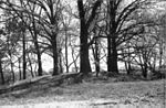
Nunica is an unincorporated community in the U.S. state of Michigan. The community is located near the center of Crockery Township in Ottawa County, close to the junction of Interstate 96 (I-96) M-104 and M-231 at 43°04′47″N 86°04′02″W. The first white settlers were Manley Patchin in 1836 and William Hathaway, Jr., in 1839. Hathaway became the first postmaster of Crockery Creek on February 7, 1848. The name of the post office was changed to Nunica on January 8, 1859. The settlement was first platted by Henry Ernst in 1865. The name Nunica is derived from the Native American word menonica, meaning "clay earth", from which pottery was made. This clay was also the origin for the name of Crockery Creek. The Nunica ZIP code 49448 serves most of Crockery Township, as well as portions of Sullivan Township in Muskegon County to the north and small areas of Polkton Township to the east.
Excerpt from the Wikipedia article Nunica, Michigan (License: CC BY-SA 3.0, Authors).Nunica, Michigan
South Street, Crockery Township
Geographical coordinates (GPS) Address Nearby Places Show on map
 Continue reading on Wikipedia
 Geographical coordinates (GPS)
| Latitude | Longitude |
|---|---|
| N 43.079722222222 ° | E -86.067222222222 ° |
Address
South Street 11198
49448 Crockery Township
Michigan, United States
Open on Google Maps