place

Chateauguay River

International rivers of North AmericaRivers of Clinton County, New YorkRivers of Franklin County, New YorkRivers of MontérégieRivers of New York (state)
Roussillon Regional County MunicipalityTributaries of the Saint Lawrence River
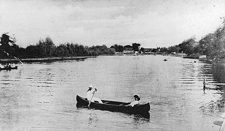
Riviere Chateauguay 1910

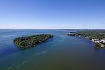
The Chateauguay River (or Chateaugay River in the United States, Mohawk: Oshahrhè:’on) is a tributary of the South Shore of the St. Lawrence River, flowing in: Clinton County and Franklin County, in the Adirondacks, in New York State, in United States; the Le Haut-Saint-Laurent Regional County Municipality: crossing the municipalities of Huntingdon, Ormstown and Howick, in Montérégie, in Quebec, in Canada; the MRC of Beauharnois-Salaberry Regional County Municipality: municipality of Sainte-Martine, in Montérégie; the MRC of Roussillon Regional County Municipality: city of Mercier, in Montérégie.This valley is mainly served by the following roads: in Quebec (East side, from the mouth): boulevard Salaberry Nord, boulevard Salaberry Sud, chemin du rang Roy, chemin de la Beauce, rue Saint-Joseph, boulevard Saint-Jean-Baptiste-Ouest (route 138), Island Road, Fairview Road, Athelstan Road, Montée de Powerscour; in Quebec (West side, from the mouth): boulevard D'Youville, chemin de la Haute-Rivière, chemin du Grand-Marais, chemin du rang Dubuc, chemin du rang Touchette, chemin du rang Laberge, chemin de la Rivière-Châteauguay, rue Lambton, route 138A, route 138 (rue Châteauguay), ascent Gillmore, ascent Shearer; in New York State (East side, from the border): Simms Road, Chasm Road, Commons Road, Lake Street (NY 374); in New York State (west side, from the border): Lewis Road, Cemetery Road, Healy Road, Chase Road, Merrill Road, Lake Road, Narrows Road, Gadway Road.This territory, located in the Montérégie administrative region, is made up of twenty-eight (28) watersheds that flow into the St. Lawrence River and includes thirty-nine (39) municipalities and cities. The Châteauguay River watershed has a relatively dense population of approximately 215,000 people who place significant stress on the region's water resources, 41% of which rely on groundwater as a source of supply. The river surface is generally frozen from mid-December to the end of March. Safe circulation on the ice is generally done from the end of December to the beginning of March. The water level of the river varies with the seasons and the precipitation.

Excerpt from the Wikipedia article Chateauguay River (License: CC BY-SA 3.0, Authors, Images).

Chateauguay River
Chemin du Bord-de-l'Eau,

Geographical coordinates (GPS) Address Nearby Places
placeShow on map

Wikipedia: Chateauguay RiverContinue reading on Wikipedia

Geographical coordinates (GPS)

Latitude Longitude
N 45.401 ° E -73.752 °
placeShow on map

Address

Chemin du Bord-de-l'Eau 167
J6J 1Z9
Quebec, Canada
mapOpen on Google Maps

Riviere Chateauguay 1910
Share experience

Nearby Places

Dorval station (Exo)

Dorval station (French: Gare Dorval) is an intermodal bus and commuter rail station in Dorval, Quebec, Canada located on the Vaudreuil–Hudson line (exo1) of the Greater Montreal Exo public transport network. It is located within walking distance to inter-city rail services at Dorval Via Rail station. Dorval is in ARTM fare zone A, and the station currently has 372 parking spaces. The adjacent STM bus terminal rivals the Fairview Bus Terminal as the busiest in the West Island but serves as the main interchange and the fastest link to Downtown Montreal for West Island travelers. The 211 bus route is the quickest link to a Metro station from the West Island. Nine Metro stations are served via the Dorval bus terminal, the most of any West Island train station. Roughly 15,000 people transit through the terminus daily, or 4.14 million a year. As of October 2020, on weekdays, all 11 inbound trains and 12 outbound trains on the line call at this station. On weekends, all trains (four on Saturday and three on Sunday in each direction) call here.The station is located north of Autoroute 20 alongside the Dorval Circle interchange, about one kilometre south of Montreal-Pierre Elliott Trudeau International Airport. The station has two side platforms; access between them is provided by a tunnel connecting the large headhouses on either side of the tracks with the bus terminal building to the south. The current commuter station and bus terminal opened on August 29, 1988.Despite the proximity of the airport, there is no direct pedestrian or transit access other than the infrequent route 204 bus. Due to the construction of the Réseau express métropolitain (REM) rapid transit link to the airport, there have been calls for the connection to be extended one kilometre south to link with the train and bus stations here.

West Island
West Island

The West Island (French: l'Ouest de l'île) is the unofficial name given to the city, towns and boroughs at the western end of the Island of Montreal, in Quebec, Canada. It is generally considered to consist of the Lakeshore municipalities of Dorval, Pointe-Claire, and Beaconsfield, the municipalities of Kirkland, Dollard-des-Ormeaux, Baie-D'Urfé, Sainte-Anne-de-Bellevue, the village of Senneville, and two North Shore boroughs of the city of Montreal: Pierrefonds-Roxboro and L'Île-Bizard–Sainte-Geneviève. Historically, there was a linguistic division of the island of Montreal into French and English 'halves', with Francophones typically inhabiting the eastern portion of the island and Anglophones typically inhabiting the western half. The West Island's population is approximately 234,000 and although the overwhelming majority of its residents are today bilingual if not multi-lingual (given the cosmopolitan nature of this vast suburban area), anglophones still make up a plurality of the West Island's population. As late as the 1960s, much of the West Island was farmland populated by French Canadians, which in turn accounts for a significant Francophone cultural influence in the region. The region is home to the Montréal–Trudeau International Airport, John Abbott College, Cégep Gérald-Godin, the Macdonald Campus of McGill University, the Fairview Pointe-Claire and Galeries des Sources malls, as well as Montreal's largest park, the Cap-Saint-Jacques Nature Park. Hospitals include the Veteran's Hospital in Sainte-Anne's and the Lakeshore General Hospital in Pointe-Claire. Municipalities range in character from the modern bedroom communities of Kirkland or Dollard-des-Ormeaux to the former cottage-country homes of Dorval, Pointe Claire and Beaconsfield. Development and the concentration of industrial activity along highways 20, 40 and 13 over the last twenty years has made securing the region's remaining tracts of open land a priority for many West Island residents. The West Island is home to one of the last large remaining tracts of Montreal-region wilderness on island.