place

Shrewsbury Abbey railway station

Buildings and structures in ShrewsburyDisused railway stations in ShropshirePages with no open date in Infobox stationRailway stations in Great Britain closed in 1866Railway stations in Great Britain closed in 1880
Railway stations in Great Britain closed in 1933Railway stations in Great Britain opened in 1866Railway stations in Great Britain opened in 1868Railway stations in Great Britain opened in 1911Use British English from March 2017
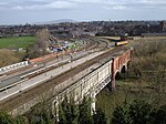
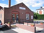
Abbey Rail Station geograph.org.uk 98016

Shrewsbury Abbey was a railway station in Shrewsbury, Shropshire, England part of the Shropshire and Montgomeryshire Railway. It was named after the nearby Shrewsbury Abbey. The station had an adjacent goods yard and wagon building works. Shrewsbury Abbey was originally planned to be just one station on a railway from Llanymynech to Market Drayton but when financial problems halted the project, it became the permanent terminus. However it was never connected to Shrewsbury Station. All passenger services would have to change here. This was because access to the mainline station was rejected on financial grounds and the obstruction of Shrewsbury station's joint operators, the Great Western Railway (GWR) and the London and North Western Railway.

Excerpt from the Wikipedia article Shrewsbury Abbey railway station (License: CC BY-SA 3.0, Authors, Images).

Shrewsbury Abbey railway station
Old Potts Way,

Geographical coordinates (GPS) Address Nearby Places
placeShow on map

Wikipedia: Shrewsbury Abbey railway stationContinue reading on Wikipedia

Geographical coordinates (GPS)

Latitude Longitude
N 52.7069 ° E -2.7435 °
placeShow on map

Address

Abbey Foregate

Old Potts Way
SY3 7BP , Coleham
England, United Kingdom
mapOpen on Google Maps

Abbey Rail Station geograph.org.uk 98016
Share experience

Nearby Places

Wakeman School
Wakeman School

The Wakeman School and Arts College (formerly Shrewsbury Technical High School) was a co-educational comprehensive school located in Shrewsbury, the county town of Shropshire, England. The school was the only state secondary school in the town centre, located just to the east of the English Bridge. The school was awarded the ‘Artsmark Gold’ by Arts Council England, and a new ICT facility was completed during the summer holidays of 2008.In September 2008 the school was granted Specialist School status for Visual Art with Music and Drama in recognition of its particular strengths in these areas. The extra funding available was used to enhance and upgrade facilities for these subjects including setting up a state-of-the-art’ Multimedia Studio. In March 2011 inspection, Ofsted judged the school to be 'Good' with 'Outstanding' features. The report praised "the outstanding leadership of its headteacher" and wrote "This is a good school which has improved rapidly. All groups of students make at least good progress... Students, parents and carers repeatedly told inspectors that the school is one big, warm family." In 2011 the school progressed to 61.5% of students achieving at least 5 GCSEs at grades A* to C, including English and Maths.In September 2011 as part of its cuts, Shropshire Council decided that the school should close. Despite a ferocious 'Why Waste Wakeman' campaign by staff, students, parents, governors and the wider community the school formally closed on 19 July 2013.To mark its closure and celebrate its role in Shrewsbury the school created The Wakeman 'Look Up' Art Town Trail featuring the work of Wakeman students spanning over 30 years as a lasting legacy to the school. Following the school's closure, its former site is now used by Shrewsbury Sixth Form College.

Rea Brook
Rea Brook

The name Rea Brook can refer to either of two brooks in Shropshire, England. One of the brooks, which eventually becomes the River Rea, is in southern Shropshire. It is to the east of Brown Clee Hill.The other, described here, is a minor river that begins at Marton Pool, near the Wales-England border. This runs northeast for 40 kilometres (25 mi) past the villages of Minsterley, Pontesbury, Hanwood, Hook-a-Gate and Bayston Hill to Shrewsbury, where it joins the much larger River Severn at Coleham Head. It is noted in the county for its wildlife, such as otters and kingfishers. Previously in history, it was known as the "Meole Brook", and gives its name to two villages near Shrewsbury – Meole Brace and Cruckmeole.Rea Brook has changed dramatically since the start of the 21st century with a downturn in the recorded numbers of coarse fish. The Environment Agency put this down to the brook changing from a high capacity watercourse into a fast flowing one. It has been noted that the brook is still plentiful with salmonid type fish. When the brook reaches Shrewsbury, it flows through a local nature reserve designated in 1994 as the Reabrook Valley Country Park. The valley is noted for its wildlife, specifically otters and orchids that are rare in that part of Shropshire. In its final reaches it curves westwards to its confluence with the River Severn just off Coleham Head in the town. The brook flooded extensively in 2000, 2007 and 2010.After the flooding in 2000, it was suggested that a tunnel and culvert be created to divert water away from Rea Brook eastwards where it would enter the River Severn a point further downstream and out of the environs of Shrewsbury. As the cost of this work would have exhausted the funds put aside for flood defences in the town, it was discounted.The 2007 flooding destroyed a bridge which was rebuilt in 2008 with additional archaeological excavations on the leat that ran alongside the Rea Brook in the valley at Shrewsbury. The leat (or mill race) had existed since the medieval period, and was disused at the time of the flooding. The bridge repairs necessitated diverting the Rea Brook into the former leat.The pronunciation of "Rea" varies between REE and RAY. The pronunciation most used by locals for the Shrewsbury river is ; the pronunciation may have been introduced by incomers from Birmingham, where a different River Rea is pronounced that way.

English Bridge
English Bridge

The English Bridge is a masonry arch viaduct, crossing the River Severn in Shrewsbury, Shropshire. The present bridge is a 1926 rebuilding and widening (re-using the original masonry) of John Gwynn's design, completed in 1774. A bridge is known to have stood at this spot since at least Norman times. Historically, it was known as the "Stone Bridge". It is a Grade II* listed building.The original Norman bridge consisted of five arches and a timber causeway. It linked the town of Shrewsbury with Coleham Island, which now no longer exists, before another bridge linked the island with the other bank. A large tower stood on the East bank, housing a gate and a drawbridge. The bridge also supported several shops and houses. Building work on Gwynn's replacement bridge started on 29 June 1769, and comprised seven semicircular arches, 400 feet (120 m) long. This bridge cost £16,000. The 55-foot (17 m) span central arch was built high, to provide headroom to watercraft, but this resulted in steep approaches. As a result, a new design was put forward in 1921 by Arthur W. Ward, the Borough Surveyor. This lowered all the arches, converting the central one into a segmental arch, reducing the height of the roadway by 5 feet (1.5 m). The new bridge was to be 50 feet (15 m) wide, more than twice as wide as Gwynn's structure (of 23 and a half feet width). It cost £86,000 and was formally opened on 26 October 1927 by Queen Mary, although it had been completed the previous year. Ward's bridge reused the old masonry, each stone carefully numbered, as well as a quantity of new stonework. Concrete was used to 'saddle' the arches and in the foundations. The bridge is one of two bridges carrying the main east-west route over the Severn as it loops around Shrewsbury; the Welsh Bridge is its counterpart on the other side of the town. Despite the names, both bridges are in England, but the Welsh Bridge is on the side closer to Wales. Thomas Telford's Holyhead Road, dating from 1815 and connecting London to the main sea-crossing to Ireland, used the English Bridge to cross the Severn here. The road's modern successor, the A5, now bypasses Shrewsbury and the bridge's main role today is to connect the centre of Shrewsbury with the Belle Vue and Abbey Foregate areas of the town.