place

Angela Park (amusement park)

1957 establishments in Pennsylvania1988 disestablishments in PennsylvaniaAmusement parks closed in 1988Amusement parks opened in 1957Buildings and structures in Luzerne County, Pennsylvania
Defunct amusement parks in PennsylvaniaTourist attractions in Luzerne County, Pennsylvania

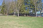
Angela Park was an amusement park located along PA Route 309 in Butler Township, seven miles north of Hazleton, Pennsylvania. The park operated from 1957 through 1988, and its proximity to the Pocono Mountains made it a popular summer attraction in Northeastern Pennsylvania for thirty years. It was owned and operated as part of the Barletta Family enterprises until 1985. Then it was sold to Mirth Master Corp. of Chester County, PA, who operated the park until 1988. After the 1988 season, the ownership filed for bankruptcy. In 1990, the rides and equipment were auctioned off. During the late 1990s, many of the buildings were razed. During the 2000s, the former park served as a training field for Lackawanna College training program for Lackawanna County policemen. Today, the property is owned by New Land Development of Lackawanna County and is undeveloped.

Excerpt from the Wikipedia article Angela Park (amusement park) (License: CC BY-SA 3.0, Authors).

Angela Park (amusement park)
North Church Street, Butler Township

Geographical coordinates (GPS) Address Nearby Places
placeShow on map

Wikipedia: Angela Park (amusement park)Continue reading on Wikipedia

Geographical coordinates (GPS)

Latitude Longitude
N 41.035 ° E -75.951 °
placeShow on map

Address

North Church Street

North Church Street
18222 Butler Township
Pennsylvania, United States
mapOpen on Google Maps

Share experience

Nearby Places

Little Nescopeck Creek

Little Nescopeck Creek is a tributary of Nescopeck Creek in Luzerne County, Pennsylvania, in the United States. It is approximately 8.5 miles (13.7 km) long and flows through Butler Township, Sugarloaf Township, and Conyngham. The watershed of the creek has an area of 14.0 square miles (36 km2). The creek is acidic and receives mine water from the Jeddo Tunnel. The main rock formation in the watershed is the Mauch Chunk Formation. However, the Pottsville Formation also appears in some areas. Soil series in the drainage basin include the Arnot Series, the Basher Series, and various other soil types. There is one source of acid mine drainage in the watershed of Little Nescopeck Creek: the Jeddo Tunnel. Major roads in the creek's watershed include Interstate 80, Pennsylvania Route 93, and Pennsylvania Route 309. Additionally, wetlands occur in the drainage basin. The watershed of the creek was inhabited by 8000 B.C.E. However, European settlers did not arrive until the 18th century. The Sugarloaf Massacre occurred near the creek in 1780. Recreational opportunities in the watershed include swimming and boating, and there are golf courses, public parks, and rail-trails in within the watershed. The watershed of Little Nescopeck Creek is designated as a Coldwater Fishery and a Migratory Fishery. Several fish species inhabit the creek near its headwaters, but there is no aquatic life downstream of the Jeddo Tunnel. Fourteen amphibian species and eight reptile species also inhabit the watershed; some of them breed there as well. Dozens of species of insects and macroinvertebrates live in the creek's drainage basin. Common mammals include white-tailed deer, cottontail rabbits, and others. Plants inhabiting the watershed include conifer and hardwood trees, herbs, legumes, and grasses.