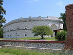
Bavaria-Ingolstadt
1447 disestablishmentsDuchies of the Holy Roman EmpireDuchy of BavariaFormer states and territories of BavariaIngolstadt ... and 1 more
States and territories established in 1392

Bavaria-Ingolstadt (German: Bayern-Ingolstadt or Oberbayern-Ingolstadt) was a duchy which was part of the Holy Roman Empire from 1392 to 1447.
Excerpt from the Wikipedia article Bavaria-Ingolstadt (License: CC BY-SA 3.0, Authors, Images).Bavaria-Ingolstadt
Baggerweg, Ingolstadt Herz-Jesu-Viertel (Südwest)
Geographical coordinates (GPS) Address Nearby Places Show on map
Geographical coordinates (GPS)
| Latitude | Longitude |
|---|---|
| N 48.75 ° | E 11.416666666667 ° |
Address
DAV Kletterzentrum
Baggerweg 2
85051 Ingolstadt, Herz-Jesu-Viertel (Südwest)
Bavaria, Germany
Open on Google Maps


