place

London Borough of Hackney

1965 establishments in the United KingdomEngvarB from May 2020Incomplete lists from August 2021London Borough of HackneyLondon boroughs
Pages including recorded pronunciations
Hackney UK locator map

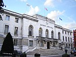
The London Borough of Hackney ( (listen) HAK-nee) is a North-East London borough in Inner London. The historical and administrative heart of Hackney is Mare Street, which lies 5 miles (8 km) north-east of Charing Cross. The borough is named after Hackney, its principal district. Southern and eastern parts of the borough are popularly regarded as being part of east London, with the northwest belonging to north London. Its population is 281,120 inhabitants. The London Plan issued by the Greater London Authority assigns whole boroughs to sub-regions for statutory monitoring, engagement and resource allocation purposes. The most recent (2011) iteration of this plan assigns Hackney to the ‘East’ sub-region, while the 2008 and 2004 versions assigned the borough to "North" and "East" sub-regions respectively. The modern borough was formed in 1965 by the merger of the Metropolitan Borough of Hackney with the much smaller Metropolitan Boroughs of Stoke Newington and Shoreditch. Hackney is bounded by Islington to the west, Haringey to the north, Waltham Forest to the north-east, Newham to the east, Tower Hamlets to the south-east and the City of London to the south-west. Hackney was one of the host boroughs of the London Olympics in 2012, with several of the Queen Elizabeth Olympic Park venues falling within its boundaries.

Excerpt from the Wikipedia article London Borough of Hackney (License: CC BY-SA 3.0, Authors, Images).

London Borough of Hackney
Atkins Square, London Clapton (London Borough of Hackney)

Geographical coordinates (GPS) Address Nearby Places
placeShow on map

Wikipedia: London Borough of HackneyContinue reading on Wikipedia

Geographical coordinates (GPS)

Latitude Longitude
N 51.55 ° E -0.058333333333333 °
placeShow on map

Address

Atkins Square 13
E5 8HH London, Clapton (London Borough of Hackney)
England, United Kingdom
mapOpen on Google Maps

Hackney UK locator map
Share experience

Nearby Places

Banner Repeater

Banner Repeater is an artist run reading room and project space, on Hackney Downs railway station, Dalston Lane, London. It is named after the "banner repeater", a type of railway signal used in Great Britain. The reading room holds a collection of artist's books and other printed material, for both browsing and purchase. The permanent collection is home to Publish And Be Damned's public library. The project space arts programme, of exhibitions, events and performance, publishes pamphlets and posters, which are free to take away from the library trolley on the platform, and when closed from a box outside the reading room. The project is driven by its location within a working station environment, developing critical art in the public realm, in the natural interstice the platform and incidental footfall of over 4,000 passengers a day provides. Banner Repeater is open from 8 to 11 am Tuesday to Thursday, to target the early morning commuters, as well as more usual gallery hours of 8 am to 6 pm on Friday and noon to 6 pm over the weekend.The project was supported for the first year by an Empty Shop Fund grant from the local government initiative, Art in Empty Spaces 2010, and an Arts Council England grant for the arts programme 2010-11. Banner Repeater is one of a series of projects supported by Hackney Council intended to bring empty shops and premises back to life. The projects are financed by central government funding awarded to the Council for the first year, and are to provide activities that will benefit Hackney's residents and visitors.