River Fal
Cornish KillasFal catchmentFalmouth, CornwallNature Conservation Review sitesRivers of Cornwall ... and 3 more
Sites of Special Scientific Interest in CornwallSpecial Areas of Conservation in CornwallUse British English from September 2017

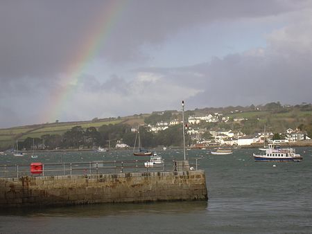
The River Fal (Standard Written Form: Dowr Fala) flows through Cornwall, rising at Pentevale on Goss Moor (between St. Columb and Roche) and reaching the English Channel at Falmouth. On or near the banks of the Fal are the castles of Pendennis and St Mawes as well as Trelissick Garden. The River Fal separates the Roseland peninsula from the rest of Cornwall. Like most of its kind on the south coast of Cornwall and Devon, the Fal estuary is a classic ria, or drowned river valley. The Fal estuary from Tregony to the Truro River was originally called Hafaraell (Cornish: Havarel, meaning fallow place).
Excerpt from the Wikipedia article River Fal (License: CC BY-SA 3.0, Authors, Images).River Fal
Geographical coordinates (GPS) Address Nearby Places Show on map
Geographical coordinates (GPS)
| Latitude | Longitude |
|---|---|
| N 50.25 ° | E -4.95 ° |
Address
TR2 5UB , Tregony with Cuby
England, United Kingdom
Open on Google Maps


