Mira Mesa, San Diego
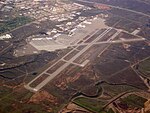
Mira Mesa (Spanish for "Table View") is a community and neighborhood in the city of San Diego, California. The city-recognized Mira Mesa Community Plan Area is roughly bounded by Interstate 15 on the east, Interstate 805 on the west, the Los Peñasquitos Canyon on the north and Marine Corps Air Station Miramar on the south. Most of the community plan area is referred to as Mira Mesa; the community plan area also includes the neighborhoods of Sorrento Valley and Sorrento Mesa.The Mira Mesa neighborhood, as defined by the San Diego Police Department's neighborhood map, is roughly bounded by Interstate 15 to the east, Camino Santa Fe to the west, the Los Peñasquitos Canyon to the north and Carroll Canyon to the south.
Excerpt from the Wikipedia article Mira Mesa, San Diego (License: CC BY-SA 3.0, Authors).Mira Mesa, San Diego
Camino Ruiz, San Diego Mira Mesa
Geographical coordinates (GPS) Address Nearby Places Show on map
Geographical coordinates (GPS)
| Latitude | Longitude |
|---|---|
| N 32.915555555556 ° | E -117.14388888889 ° |
Address
Camino Ruiz
Camino Ruiz
92126 San Diego, Mira Mesa
California, United States
Open on Google Maps


