Mount Ascutney

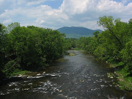
Mount Ascutney is a mountain in the U.S. state of Vermont. At 3,144 feet (958 m), it is the highest peak in Windsor County. Mount Ascutney is a monadnock that rises abruptly from the surrounding lowlands. For example, the Windsor Trail is 2.7 miles (4.3 km) to the summit with 2,514 feet (766 m) of elevation gain and an overall 18% grade. Particularly noteworthy are the mountain's granite outcrops, one of which, near the summit, serves as a launching point for hang-gliders. The mountain's base straddles several villages — Ascutney, Brownsville, Windsor, and West Windsor — and it is located only several miles off exit 8 on Interstate 91 in Mount Ascutney State Park. The mountain itself is visible from the top of Mount Washington, seventy miles away.
Excerpt from the Wikipedia article Mount Ascutney (License: CC BY-SA 3.0, Authors, Images).Mount Ascutney
Slab Trail,
Geographical coordinates (GPS) Address Nearby Places Show on map
Geographical coordinates (GPS)
| Latitude | Longitude |
|---|---|
| N 43.4445164 ° | E -72.4537019 ° |
Address
Slab Trail
Slab Trail
05037
Vermont, United States
Open on Google Maps


