Netherbury
Civil parishes in DorsetVillages in Dorset

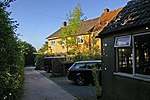
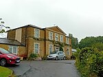
Netherbury is a village and civil parish in the English county of Dorset. It lies within the Dorset Council administrative area, by the small River Brit, 1.5 miles (2.4 km) south of Beaminster and 4 miles (6.4 km) north of Bridport. The A3066 road connecting those towns lies 0.5 miles to the east.
Excerpt from the Wikipedia article Netherbury (License: CC BY-SA 3.0, Authors, Images).Netherbury
Chantry Street,
Geographical coordinates (GPS) Address Nearby Places Show on map
Geographical coordinates (GPS)
| Latitude | Longitude |
|---|---|
| N 50.7908 ° | E -2.7535 ° |
Address
Chantry Street
DT6 5PD , Netherbury
England, United Kingdom
Open on Google Maps


