place

Higher Hurdsfield

Cheshire geography stubsCivil parishes in CheshireVillages in Cheshire
Bridge number 33, Macclesfield Canal geograph.org.uk 261306

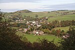
Higher Hurdsfield is a village and civil parish in the unitary authority of Cheshire East and the ceremonial county of Cheshire, England. Higher Hurdsfield Parish Council is the lowest tier of government serving the residents. It has a population of around 300, increasing at the 2011 Census to 717, and is situated on the eastern outskirts of Macclesfield, approximately 7 miles (11 km) from the border of Derbyshire and Cheshire. The nearest village is Rainow. Hurdsfield Golf Club (now defunct) was founded in 1900. The club continued until the time of WW2.

Excerpt from the Wikipedia article Higher Hurdsfield (License: CC BY-SA 3.0, Authors, Images).

Higher Hurdsfield
Rainow Road,

Geographical coordinates (GPS) Address Nearby Places
placeShow on map

Wikipedia: Higher HurdsfieldContinue reading on Wikipedia

Geographical coordinates (GPS)

Latitude Longitude
N 53.271 ° E -2.096 °
placeShow on map

Address

Rainow Road

Rainow Road
SK10 5TD , Higher Hurdsfield
England, United Kingdom
mapOpen on Google Maps

Bridge number 33, Macclesfield Canal geograph.org.uk 261306
Share experience

Nearby Places

Kerridge Hill
Kerridge Hill

Kerridge Hill (also called Kerridge Ridge) is a hill in Cheshire, near the hamlet of Kerridge on the outskirts of Bollington. The summit is 313 metres (1,027 ft) above sea level. The River Dean runs along the eastern foot of the hill. White Nancy is a prominent landmark towards the north end of the ridge. The white-washed, sugarloaf-shaped folly was erected in 1817 for John Gaskell Junior of North End Farm, as a monument to the Duke of Wellington's victory at the Battle of Waterloo. The structure was built of rendered sandstone rubble. The entrance is now blocked but inside is a room with and a circular stone table surrounded by a curved stone bench. It is a protected Grade II listed building.Kerridge Hill is a designated nature reserve, managed and owned (since 2019) by the Cheshire Wildlife Trust. The reserve is a species-rich grassland with an abundance of native wildflowers including betony, devils-bit scabious and knapweed. This grassland habitat attracts pollinators such as bumblebees and 10 butterfly species, including small heath, wall brown and small skipper. Blackcap, chiffchaff and tawny owls are among the birds which inhabit the reserve. In autumn the rare waxcap mushroom spreads through the grass sward.On the west side of the ridge are Bridge Quarry (formerly Victoria Quarry, combining Bridge End Quarry and Sycamore Quarry) and Marksend Quarry (formerly Parks End Quarry). The boundary between the two quarries is marked with an estate boundary stone, which is dated 1830. The ashlar sandstone block, at the base of a dry stone wall, is designated Grade II on the national heritage list. Below Bridge Quarry is Endon Hall, which was built in the 1830s by William Clayton who owned the local quarries. In the mid-1940s, the Royal Signal Corps Trials Unit based at Catterick would drive a truck-mounted dish-shaped transmitter/receiver up onto Kerridge Hill. Here they tested cathode-ray tube transmission and reception (data-based, not images), to a mobile receiving station on another truck. The receiver would be driven further and further south over time, until eventually the lads at Kerridge Hill were sending a signal to the south coast of the country.The Gritstone Trail footpath runs along the ridge between Tower Hill and White Nancy.The Peak District Boundary Walk long-distance footpath follows the same route along the ridge as the Gritstone Trail but continues through Bollington. Kerrridge Hill is just outside the Peak District National Park, its boundary lying less than 1km to the east.

Bollington railway station

Bollington railway station was a railway station serving the town of Bollington in Cheshire, England. It was opened in 1869 by the Macclesfield, Bollington and Marple Railway (MB&M) - a joint line constructed and operated by the Manchester, Sheffield and Lincolnshire Railway (MS&L) and North Staffordshire Railways (NSR). The passenger station was on the north side of Grimshaw Lane, with a goods yard on the south side. Initially services ran between Macclesfield and Marple, but this was soon extended so that direct trains ran between Macclesfield and Manchester London Road. A number of additional services were supplied between Bollington and Macclesfield, as a significant number of Macclesfield workers lived in Bollington. In 1921, there were 14 additional shuttle services between the two towns using a petrol railcar purchased by the Great Central Railway (GCR) (successor to the MS&L) and nicknamed the "Bollington Bug". The Bug was replaced in 1935 by a Sentinel steam railcar that ran the shuttle service, until it was withdrawn at the start of 1939.The station buildings were built to NSR designs, as were most other structures on the MB&M, while most train services were operated by the MS&L and later the GCR. An exception to this being the NSR Summer Saturday services between Macclesfield and Buxton.The station closed in January 1970, along with the line between Macclesfield and Marple; the buildings were demolished and the track was lifted by the end of 1971. The trackbed now forms part of the Middlewood Way, a recreational path between Macclesfield and Marple. Part of the goods station site provides a car park for the path.