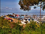
Richmond–San Rafael Bridge
1956 establishments in CaliforniaBridges completed in 1956Bridges in Contra Costa County, CaliforniaBridges in Marin County, CaliforniaBridges in the San Francisco Bay Area ... and 16 more
Bridges on the Interstate Highway SystemBuildings and structures in Richmond, CaliforniaBuildings and structures in San Rafael, CaliforniaCantilever bridges in the United StatesDouble-decker bridgesLandmarks in the San Francisco Bay AreaPedestrian bridges in CaliforniaPratt truss bridges in the United StatesRoad bridges in CaliforniaSan Francisco BaySan Francisco Bay TrailSteel bridges in the United StatesToll bridges in CaliforniaTolled sections of Interstate HighwaysTrestle bridges in the United StatesUse mdy dates from September 2019

The Richmond–San Rafael Bridge (also officially named the John F. McCarthy Memorial Bridge) is the northernmost of the east–west crossings of the San Francisco Bay in California, USA. Officially named after California State Senator John F. McCarthy, it bridges Interstate 580 from Richmond on the east to San Rafael on the west. It opened in 1956, replacing ferry service by the Richmond–San Rafael Ferry Company.
Excerpt from the Wikipedia article Richmond–San Rafael Bridge (License: CC BY-SA 3.0, Authors, Images).Richmond–San Rafael Bridge
Richmond-San Rafael Bridge Bicycle and Pedestrian Path, Richmond
Geographical coordinates (GPS) Address Nearby Places Show on map
Geographical coordinates (GPS)
| Latitude | Longitude |
|---|---|
| N 37.9347 ° | E -122.4338 ° |
Address
Richmond-San Rafael Bridge Bicycle and Pedestrian Path
Richmond-San Rafael Bridge Bicycle and Pedestrian Path
94964 Richmond
California, United States
Open on Google Maps


