place

Santa Clara River Valley

River valleys of the United StatesSanta Clara River (California)Santa Paula, CaliforniaValleys of CaliforniaValleys of Ventura County, California
Ventura County, California geography stubs
Santa Clara River Valley 2015

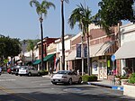
The Santa Clara River Valley is a rural, mainly agricultural, valley in Ventura County, California that has been given the moniker Heritage Valley by the namesake tourism bureau. The valley includes the communities of Santa Paula, Fillmore, Piru and the national historic landmark of Rancho Camulos. Named for the Santa Clara River, which winds through the valley before emptying into the Pacific Ocean between the cities of Ventura and Oxnard, the tourist bureau describes it as ".... Southern California's last pristine agricultural valley nestled along the banks of the free-flowing Santa Clara River."

Excerpt from the Wikipedia article Santa Clara River Valley (License: CC BY-SA 3.0, Authors, Images).

Santa Clara River Valley

Geographical coordinates (GPS) Address Nearby Places
placeShow on map

Wikipedia: Santa Clara River ValleyContinue reading on Wikipedia

Geographical coordinates (GPS)

Latitude Longitude
N 34.366666666667 ° E -118.98333333333 °
placeShow on map

Address


California, United States
mapOpen on Google Maps

Santa Clara River Valley 2015
Share experience

Nearby Places

Bardsdale United Methodist Church

Bardsdale United Methodist Church is a historic church located at 1498 Bardsdale Avenue in the unincorporated community of Bardsdale, California, in Ventura County. It is south of the Santa Clara River approximately 3 miles (5 km) from Fillmore. Built in 1898, as Bardsdale Methodist Episcopal Church, this carpenter Gothic structure with a 60 ft (18 m) bell tower and high-peaked arches has long been a center of community life in Bardsdale. The town's namesake, Thomas R. Bard, donated the land for construction of the church and parsonage. He also donated funds to help purchase two large stained glass windows installed in the north and west walls. When the church opened, in April 1898, the Los Angeles Times reported on its dedication:"The Bardsdale Methodist Episcopal Church was dedicated last Sunday by Dr. G.W. White of Los Angeles. The building cost $2550, will seat 350 persons, and has a fine basement fitted for social gatherings. There was $550 remaining due on the building, which was subscribed Sunday morning." On April 23, 1968, the Methodist Church was merged with the Evangelical United Brethren Church to form the United Methodist Church. The name was then changed to Bardsdale United Methodist Church. A portion of the ceiling fell on a parishioner during a service in 1982, leading to an extensive renovation. The renovation and restoration work included materials purchased from a church in Los Angeles that had closed in 1982. The materials salvaged from that church included stained-glass windows, an oak chancel, chandeliers, pews, marble facing around the interior doors, a hand-carved pulpit, lectern and communion rail.The church also features a Schoenstein pipe organ that was purchased in 1986, with $60,000 donated by parishioners. In a tradition dating back to the mid-1960s, the Bardsdale Chancel Choir performs a free holiday vesper program during the Christmas season.The Ventura County Cultural Heritage Board designated the clapboard church County Landmark #50 in 1979, calling it "the only example of carpenter Gothic in the Fillmore-Bardsdale area." The Gothic church was added to the National Register of Historic Places in 1986.

Bardsdale, California

Bardsdale is a rural unincorporated community and populated place in Ventura County, California. It is located in the orange blossom and agricultural belt of the Santa Clara River Valley, south of the Santa Clara River and on the north slope of South Mountain. The closest town is Fillmore, which is on the north side of the Santa Clara about 3 miles (5 km) from Bardsdale. Santa Paula is about 7 miles (11 km) west, the most direct route being South Mountain Road. Moorpark is about 6 miles (10 km) south over the serpentine mountain road known as Grimes Canyon. The Bardsdale area has long been a center of citrus ranching, having a large number of verdant orange orchards with home sites interspersed among them. The citrus of Sunkist growers in Bardsdale is sold throughout the country and around the world. Oranges - mostly Valencias - are the main crop, other crops include lemons, avocados, and row cropped vegetables. Bardsdale gently slopes from South Mountain to the river and has a sweeping, panoramic view of the Santa Clara River Valley, dominated by the peaks of the Sespe and San Cayetano Mountains. The community is home to the Bardsdale United Methodist Church, which is listed on the National Register of Historic Places. The Bardsdale Cemetery serves the community as well as Fillmore, which has no other cemetery. The Elkins Ranch Golf Course is on the east edge of Bardsdale. The area is serviced by the Ventura County Sheriff's Department and the Ventura County Fire Department.