place

Barton Turf

Civil parishes in NorfolkNorth NorfolkOpenDomesdayVillages in Norfolk
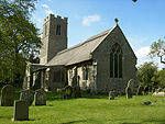
St Michael and All Angels, Barton Turf, Norfolk geograph.org.uk 481381

Barton Turf is a village and civil parish in the English county of Norfolk. It is 20 km north-east of the city of Norwich, on the northwestern edge of Barton Broad, the second largest of the Norfolk Broads. In primary local government the area is in the district of North Norfolk.The villages name means 'Barley farm/settlement'. 'Turf' is a late 14th century addition, probably indicating that turf cutting was an important local industry. The civil parish, which includes the whole of Barton Broad and the smaller village of Irstead at its southern end, has an area of 10.86 km2. In the 2001 census it had a population of 480 in 181 households, the population decreasing to 467 at the 2011 Census.Barton Turf's St Michael and All Angels Church, Barton Turf, about a mile from the clustered village centre, has a large, ornate medieval painted rood screen such as many medieval parishes who could afford fine artisans once had, but which have rarely survived the English Reformation. The 18th-century antiquarian Antony Norris lived in Barton Turf, and is buried at the church.

Excerpt from the Wikipedia article Barton Turf (License: CC BY-SA 3.0, Authors, Images).

Barton Turf
Staithe Road, North Norfolk Barton Turf

Geographical coordinates (GPS) Address Nearby Places
placeShow on map

Wikipedia: Barton TurfContinue reading on Wikipedia

Geographical coordinates (GPS)

Latitude Longitude
N 52.74796 ° E 1.48493 °
placeShow on map

Address

Staithe Road
NR12 8BB North Norfolk, Barton Turf
England, United Kingdom
mapOpen on Google Maps

St Michael and All Angels, Barton Turf, Norfolk geograph.org.uk 481381
Share experience

Nearby Places

Catfield Fen Reserve

Catfield Fen is a wetland nature reserve near Ludham in the county of Norfolk, England. Butterfly Conservation owns and manages part of this reserve. Part of the Ant Broads & Marshes National Nature Reserve, the Butterfly Conservation part of the site comprises 59 acres (24 ha). The remainder is owned privately by the Catfield Hall Estate. The nature reserve was established by the conservationist landowner Keith Arundel McDougall, son of Douglas McDougall of the McDougall of Makerstoun family. Catfield Fen is well known amongst Broadland ecologists as one of the most important areas of fen in the United Kingdom. The wide variety of plant communities support many rare species. The site is especially important for invertebrates, with an internationally important aquatic beetle assemblage including many Red Data Book species. Other rare invertebrates include the swallowtail butterfly, the lesser water measurer, small dotted footman moth and Fenn's wainscot moth. Catfield Fen also has important populations of many rare plants, of particular note are the fen orchid, the round leaved wintergreen, crested buckler fern and milk parsley. The latter being the food plant of the swallowtail butterfly. Catfield Fen has appeared in local media in 2013 and 2014 due to concerns that the site may be being affected by local agricultural water abstraction. There are two abstraction licenses up for renewal in 2014 which are being considered by the Environment Agency. Site managers, local ecologist, the Broads Authority and Natural England have all raised concerns that the hydrological modelling carried out by the Environment Agency is insufficient to conclude that it will have no significant effect on the integrity of the site. For safety reasons, the nature reserve is not open to the public, but it can be viewed from the footpath at the end of Fenside Lane, Catfield. Anglian Water recently undertook a £9m project to help protect the reserve, building a pipeline that would end the need to take local water supply from a borehole in the area.

Stalham
Stalham

Stalham is a market town and civil parish on the River Ant in the English county of Norfolk, in East Anglia. It covers an area of 2.82 sq mi (7.3 km2) and had a population of 2,951 in 1,333 households at the 2001 census, the population increasing to 3,149 at the 2011 Census. It lies within the Norfolk Broads, about 15 miles (24 km) north-east of Norwich on the A149 road. For the purposes of local government, it falls within the district of North Norfolk. The parts of the parish lying adjacent to the river fall into the executive area of the Broads Authority. The town's name probably means, "fish pool homestead/village" but perhaps, "hemmed-in land with a fish pool". Stalham was served by a railway station until it was closed in 1959. The nearest railway station is now Worstead. Through the 1960s Stalham's economy sank from a reduction of the agricultural labour force as a result of improvements in agricultural technology. Beginning in the 1970s, though, housing developments attracted people who took up residence in Stalham but worked elsewhere. The Museum of the Broads moved to Stalham in 2000 and is situated on Stalham Staithe. It "aims to bring the history of the Broads alive for locals and visitors to Norfolk" and is open to the public throughout the summer.In 2002 Tesco built a supermarket in Stalham, with considerable controversy, with many residents fearing that it would "kill the high street". Despite this, the High Street contains a wide range of independent traders.