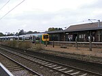
West Heath, West Midlands

West Heath is a residential area of Birmingham, England on the boundary with Worcestershire. Forming the larger part of the ward of Longbridge And West Heath it is situated between Kings Norton, Northfield, Longbridge and Cofton Hackett and lies on traditional heathland formed in the 13th century as part of the Kings Norton manorial lands, and was historically in Worcestershire. Based on a small village formed in the early 1900s that was originally centred on the medieval Lilley Lane, the majority of West Heath's expansion and growth took place just after World War II. The original expansion in the 1940s and 1950s consisted of large numbers of prefab houses, most of which were eventually replaced by permanent housing estates in the 1960s and 1970s. There are a number of buildings in West Heath that date to the 19th century and earlier. The suburb is adjacent to rural Worcestershire and a number of public footpaths allow open access to the surrounding fields up to Hopwood, Cofton Hackett and the Lickey Hills.
Excerpt from the Wikipedia article West Heath, West Midlands (License: CC BY-SA 3.0, Authors, Images).West Heath, West Midlands
Hochgesangsweg,
Geographical coordinates (GPS) Address Nearby Places Show on map
Geographical coordinates (GPS)
| Latitude | Longitude |
|---|---|
| N 52.3967 ° | E -1.9575 ° |
Address
Hochgesangsweg
Hochgesangsweg
35260 (Wolferode)
Hessen, Deutschland
Open on Google Maps


