Stockland Green
Areas of Birmingham, West MidlandsErdingtonWards of Birmingham, West MidlandsWest Midlands (county) geography stubs
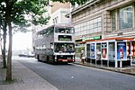
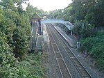
Stockland Green is an area of Birmingham, England. It gives its name to a ward which is part of the Erdington formal district, and is located to the south-west of Erdington and north-east of Birmingham City Centre. The area is often mistakenly identified as Erdington, normally through domestic and commercial addresses. The area however has its own council ward and is outside Erdington's traditional boundaries, previously in the Birmingham Aston constituency.
Excerpt from the Wikipedia article Stockland Green (License: CC BY-SA 3.0, Authors).Stockland Green
Frances Road, Birmingham
Geographical coordinates (GPS) Address Nearby Places Show on map
Geographical coordinates (GPS)
| Latitude | Longitude |
|---|---|
| N 52.5213 ° | E -1.8592 ° |
Address
Frances Road
Frances Road
B23 7LD Birmingham
England, United Kingdom
Open on Google Maps


