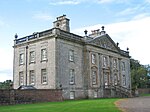
Skares
Villages in East AyrshireWest of Scotland geography stubs

Skares is a village in East Ayrshire, Scotland. Skares is located some 3 miles (5 km) southwest of Cumnock. It used to have a football team called Skares Bluebells. Skares consisted of an older core of a village and three miners terraces. They were called, The Old Raw, The New Raw and the Tap Raw. These were built as mining expanded in the area, although today the mining has gone, with the most recent mining activity being an opencast mine behind Skares, which closed in the mid 2010s. From 1872 to 1951 it was served by Skares railway station.
Excerpt from the Wikipedia article Skares (License: CC BY-SA 3.0, Authors, Images).Skares
Skares Road,
Geographical coordinates (GPS) Address Nearby Places Show on map
Geographical coordinates (GPS)
| Latitude | Longitude |
|---|---|
| N 55.42838 ° | E -4.32453 ° |
Address
Skares Road
Skares Road
KA18 2RF , Holmhead
Scotland, United Kingdom
Open on Google Maps


