place

Bear Flat

Areas of Bath, SomersetUse British English from January 2015
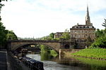
Bear Flat, Bath, from Holloway

Bear Flat is a neighbourhood within the city of Bath, Somerset, England, to the south of the city centre and to the west of Beechen Cliff (a heavily wooded escarpment on the northern side of Lyncombe Hill which features in Jane Austen's Northanger Abbey). It forms the southern part of the Widcombe and Lyncombe electoral ward. The Wellsway road (A367) to Shepton Mallet, runs through Bear Flat, forming part of the ancient British Roman Fosse Way. This was originally the main pilgrimage route from Bath and its abbey, to the nearby ecclesiastical centres of Wells and Glastonbury. Bath is a hilly city and the term 'Flat' may be derived from the way the district is defined by a short plateau at the top of the steep Wells Road and Holloway routes out of the city centre, which forms the local business district. 'Bear' has nothing to do with the animal but is believed to be a contraction of an Anglo-Saxon name 'Berewick' - 'Bere' meaning Barley and 'Wick' being a settlement - a settlement near a barley field. Such a field would have been part of Barrack Farm, which was located in the area but demolished in the 19th century to make way for housing. Physical evidence of the former farm exists at the top of the Wellsway at Odd Down with a pair of houses known as Barrack Farm Cottages.

Excerpt from the Wikipedia article Bear Flat (License: CC BY-SA 3.0, Authors, Images).

Bear Flat
Wellsway, Bath Bear Flat

Geographical coordinates (GPS) Address Website Nearby Places
placeShow on map

Wikipedia: Bear FlatContinue reading on Wikipedia

Geographical coordinates (GPS)

Latitude Longitude
N 51.3738 ° E -2.3666 °
placeShow on map

Address

The Bear

Wellsway 8-10
BA2 3AQ Bath, Bear Flat
England, United Kingdom
mapOpen on Google Maps

Website
bearbath.co.uk

linkVisit website

Bear Flat, Bath, from Holloway
Share experience

Nearby Places

Westmoreland Road goods yard

Westmoreland Road goods yard was the main Great Western Railway goods station for the city of Bath in England, situated on the main line between the passenger stations of Oldfield Park and Bath (now Bath Spa).It took its name from Westmoreland Road, by which it stood. The official name of the station is uncertain. Railway historian Colin G. Maggs variously used Westmoreland Goods Yard, Westmoreland Road goods yard and Westmoreland Yard goods depot in his book covering this part of the Great Western Railway line. The goods depot was opened in 1877, freeing space at the constrained Bath Spa station site. A small engine shed was also moved from Bath Spa to Westmoreland in 1880. The goods depot was located on the up side of the line, fronting onto the Lower Bristol Road, opposite the Newark Works of crane makers Stothert & Pitt. Further west on the down side towards Oldfield Park railway station, on the other side of Westmoreland Road, was located a goods loop and four sidings, called Bath West.One notable event was the unloading in 1903 of the special train for Buffalo Bill & His Wild West Show. A more frequent event putting heavy demands on the depot was whenever the Bath and West Show was held in Bath, and horse arrivals for the Bath Racecourse. In April 1942 German bombing caused major damage to the goods depot.Until 1911 the yard was controlled by two signal boxes, Westmoreland East and Westmoreland West. In 1911 these were replaced by a single signal box called Bath Goods.The Bath engine shed at Westmoreland closed in February 1961. The goods depot closed in May 1967, but the sidings remained open for full loads until 31 December 1980. In the 1980s the goods depot was redeveloped into an office development called The Square, with the former goods shed converted into one of the office buildings.The down side sidings (Bath West) were developed as a refuse transfer terminal, called Westmoreland Railhead, by Avon County Council in the mid-1980s, taking waste to a landfill site in Calvert, Buckinghamshire. The refuse transfer terminal remained in operation until 2011 when a new mechanical biological waste treatment plant opened in Avonmouth.A passageway at the western end of Westmoreland Station Road still gives pedestrian access under the railway to Westmoreland Street; in 2018 a review of the Widcombe public rights of way recommended that it be classified as such.

Westmoreland, Bath

Westmoreland is an area and electoral ward in the south-west of Bath, England. Although still shown on some Ordnance Survey mapping, Westmoreland is rarely used by residents as the name of an area of Bath, and is primarily used for electoral purposes within the Bath and North East Somerset unitary authority, electing two councillors.The name Westmoreland is probably derived from the house, Westmoreland Place (see 1818 and 1852 maps of Bath), that stood approximately where Westmoreland Street is today. Boundary changes for the electoral wards in Bath most recently took place at the May 2019 elections; Westmoreland remained a ward but with altered boundaries. At that election, Westmoreland elected two independents, and was the only ward in the city not to return Liberal Democrats. Confusingly Westmoreland Street, Westmoreland Drive and Westmoreland Road, as well as the former Westmoreland goods station which closed in 1967, are not in the present-day ward, but about half a kilometre away in Oldfield Park ward.Conversely, Oldfield Park railway station and a part of the Oldfield Park residential area, including Moorland Road which is a shopping district, is located in Westmoreland ward. Also in the ward is East Twerton and the one end of the Two Tunnels Greenway.The wards surrounding Westmoreland ward are: Oldfield Park to the east, Moorlands and Southdown to the south, Twerton to the west, and Newbridge and Kingsmead to the north over the River Avon, which forms the ward's northern boundary.Westmoreland has a considerable student population, from the University of Bath and Bath Spa University, both in private rental, and for Bath Spa University students accommodation blocks on former industrial land by the River Avon.

South Parade, Bath
South Parade, Bath

South Parade in Bath, Somerset, England is a historic terrace built around 1743 by John Wood, the Elder. All of the houses have been designated as Grade I listed buildings.South Parade was part of a wider scheme to build a Royal Forum, including North Parade, Pierrepont and Duke Streets, similar to Queen Square, which was never completed. Wood designed the facade, of Bath stone, after which a variety of builders completed the work with different interiors and rear elevations. Many of the buildings are now hotels and restaurants whilst some remain as private residences. The area which Wood envisaged as an area of sunken gardens matching the houses is now a car park.Numbers 1, 2 and 3 (which is now the Halcyon Hotel and now includes Circo Bar and Lounge nightclub) and numbers 4 to 8 (which became the 46 room Pratt's Hotel) form a 3-storey terrace with a double break at the centre. There is a central pediment and balustraded parapet and the central door has Ionic columns. Number 6 was associated with Sir Walter Scott in 1775.Numbers 9 to 13 became the Southbourne Hotel and is now divided into flats. Number 12 was associated with John Hunter FRS in 1785. Number 14, which was associated with Fanny Burney in 1780, is the end of terrace and next to the River Avon.On the southern side of the road is the Roman Catholic St John's Church, which was designed and built between 1861 and 1863 by Charles Francis Hansom who added the 222 foot (68 metre) spire in 1867.

North Parade, Bath
North Parade, Bath

North Parade in Bath, Somerset, England is a historic terrace built around 1741 by John Wood, the Elder. Several of the houses have been designated as Grade I listed buildings.North Parade was part of a wider scheme to build a Royal Forum, including South Parade, Pierrepont and Duke Streets, similar to Queen Square, which was never completed. Wood designed the facade, of Bath stone, after which a variety of builders completed the work with different interiors and rear elevations. Many of the buildings are now hotels and shops whilst some remain as private residences.The three-storey house at Number 1 was the home of John Palmer, who owned the Theatre Royal, Bath and instigator of the British system of mail coaches that was the beginning of the great British post office reforms with the introduction of an efficient mail coach delivery service in Great Britain during the late 18th century. He was Mayor of Bath on two occasions and Comptroller General of the Post Office, and later served as Member of Parliament for the constituency of Bath between 1801 and 1807.Numbers 2 to 6 were converted into a hotel, which included some alterations to the fabric of the building.Numbers 7 to 12 include a central projection and pediments over the doors. Number 9 is connected with Wordsworth and number 11 was home to Edmund Burke and Oliver Goldsmith, of the literary Club, in 1771.The final house, number 14, is faces the River Avon and adjoins the last house in Duke Street. It was known as Sheridan House, and later as the Gay Hotel. In the garden below the house is a little grotto dedicated to Delia.North Parade Bridge was built almost 100 years later in 1836 by William Tierney Clark. His original bridge was made of cast iron on stone abutments, with lodges and staircases. This was rebuilt in 1936, being refaced in stone over a new reinforced concrete superstructure which replaced the two outside ribs of the original eight cast-iron arches.The entrance to the council-run Sports and Leisure Centre on the Recreation Ground is to the east of the bridge. Further east on North Parade Road is the Bath Cricket Club Ground, and the Bath Law Courts which holds the Bath Magistrates' Court and the Bath County Court and Family Court.