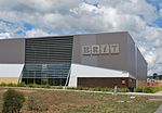
place

Bendigo School of Mines and Industries

1873 establishments in AustraliaBendigoEducation in BendigoEducational institutions established in 1873History of mining in Australia
Public schools in Victoria (state)Victoria (state) school stubs

The Bendigo School of Mines was established in Bendigo, Australia in 1873 to provide technical education, predominantly for the mining industry. It was then known as the Bendigo School of Mines and Industries from 1883 to 1959, Bendigo Technical College from 1959 to 1967, and Bendigo Institute of Technology from 1967 to 1975. Its changes of name reflected the broadening scope of the technical education it delivered. A history of the organisation was published in 1973 – "Canvas to campus: a history of the Bendigo Institute of Technology", written by Frank Cusack. In 1975 it merged with the humanities focused State College of Victoria at Bendigo (previously the Bendigo Teachers' College) to form the generalist Bendigo College of Advanced Education (1975–1990), which became the La Trobe University College of Northern Victoria on 1 January 1991. This body maintained much academic independence from the greater La Trobe University organisation until the early 2000s. It is now La Trobe University's Bendigo Campus.

Excerpt from the Wikipedia article Bendigo School of Mines and Industries (License: CC BY-SA 3.0, Authors).

Bendigo School of Mines and Industries
McCrae Street, Bendigo

Geographical coordinates (GPS) Address Website Nearby Places
placeShow on map

Wikipedia: Bendigo School of Mines and IndustriesContinue reading on Wikipedia

Geographical coordinates (GPS)

Latitude Longitude
N -36.756666666667 ° E 144.28333333333 °
placeShow on map

Address

Bendigo TAFE

McCrae Street
3550 Bendigo (Bendigo)
Victoria, Australia
mapOpen on Google Maps

Website
bendigotafe.edu.au

linkVisit website

Share experience

Nearby Places

Bendigo Post Office
Bendigo Post Office

The Bendigo Post Office is a building on Pall Mall in Bendigo, a provincial city in the Australian state of Victoria. The post office backs onto and is partly surrounded by Rosalind Park. The building was built between 1883 and 1887 by the contractors McCulloch and McAlpine and designed by Public Works architect George W. Watson in the Second Empire architectural style. The building shares a great deal with its neighbouring building, the Bendigo Law Courts, and had the same builder and designer and was built at around the same time. Notable features of the building include its 43-metre-high (141 ft) clock tower (housing a five-bell carillon) and the elaborate facades on all four sides of building. The building was extensively restored between 1978 and 1987. The building was used as a post office until 1997. It is currently used as Bendigo Tourism's Visitor Information Centre and won Victorian Tourism Awards in 2009 and 2010. It was further inducted into Victorian Tourism's hall of fame in 2011. It was also awarded a tourism award by Qantas in 2010, in the category of Visitor Information and Services. Bendigo Tourism describes the Information Centre as "Australia's Grandest Visitor Centre". The Centre boasts a large information area, an adjoining First Nations Gallery - Djaa Djuwima - and a Living Arts Space, which showcases some of the region's best artists. The building has been included on the Victorian Heritage Register as being of "architectural, historic, and aesthetic significance to Victoria".

Rosalind Park
Rosalind Park

Rosalind Park is an Australian park in Bendigo, Victoria. Prior to white settlement, a grassy woodland surrounded what is now called Bendigo Creek. At that time the creek was little more than a chain of pools and billabongs. The area would have been an important source of food and water for the indigenous Dja Dja Wrung people living in dry central Victoria.In the 1850s gold was discovered in the area, radically transforming the area that is now Rosalind Park. Bendigo was one of the richest gold mining regions in the world, with more gold found in the region from 1850 to 1900 than anywhere else in the world. At present it remains the seventh richest goldfield in the world. Puddling mills, shafts and piles of mine wastes and cast offs dominated the landscape. In 1852 the area was officially designated a Government Camp precinct, the bounds of which still roughly designate the park today. The Government Camp area comprised 66 acres and contained police barracks, gaol and lock-up, the former courthouse, a gold office and other government buildings, offices and quarters.In 1856 the local gold commissioner, Joseph Panton, first suggested that the camp should be turned into a park, but it was not until 1861 that 59 acres were formally reserved for the park and handed over to the Sandhurst Borough Council (now the City of Greater Bendigo). The first park gardener was appointed in 1870 and established the basic layout of Rosalind Park which remains to this day.