Dartmoor

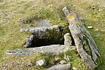
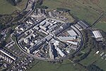
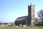
Dartmoor is an upland area in southern Devon, South West England. The moorland and surrounding land has been protected by National Park status since 1951. Dartmoor National Park covers 954 km2 (368 sq mi).The granite which forms the uplands dates from the Carboniferous Period of geological history. The landscape consists of moorland capped with many exposed granite hilltops known as tors, providing habitats for wildlife. The highest point is High Willhays, 621 m (2,037 ft) above sea level. The entire area is rich in antiquities and archaeological artefacts. Dartmoor National Park is managed by the Dartmoor National Park Authority, whose 22 members are drawn from Devon County Council, local district councils and Government. Parts of Dartmoor have been used as military firing ranges for over 200 years. The public is granted extensive land access rights on Dartmoor (including restricted access to the firing ranges) and it is a popular tourist destination.
Excerpt from the Wikipedia article Dartmoor (License: CC BY-SA 3.0, Authors, Images).Dartmoor
West Devon Dartmoor Forest
Geographical coordinates (GPS) Address Nearby Places Show on map
Geographical coordinates (GPS)
| Latitude | Longitude |
|---|---|
| N 50.566666666667 ° | E -4 ° |
Address
Blackbrook Head
PL20 6SS West Devon, Dartmoor Forest
England, United Kingdom
Open on Google Maps


