Thorpe Bassett is a village and civil parish in North Yorkshire, England. It is located between York and Scarborough in the North East of England. Surrounded by farmland the small village is home to 105 residents at the 2011 census. An increase of 4 since the 2001 census.It was historically part of the East Riding of Yorkshire until 1974 and then part of the Ryedale district from 1974 until 2023.
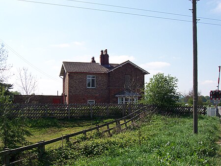
In the 18th century there were just 17 families living in the village. The main source of employment was agriculture, with the majority of residents working on farms. There was also a School, Post office and public house, all which have now closed. The school building is still standing but the Royal Oak Inn is long gone. The school was restored and converted into one larger house over a 10-year period by Jim and Sue Mortimer, assisted by Gordon Bradshaw (local joiner). This was 1981–1991. Formerly it had been a small cottage at the north gable with the larger portion being two classrooms. Whilst its use changed, it retained most of its external features. The concrete cat on the NE gable ridge, was placed there by J.M. In 1987 and resides there to this day. The water pump in the northern corner garden was placed earlier (1985), also by J.M., set in a large concrete block, to avoid unlawful removal.
In 1835 Lewis's Topographical Dictionary of England description of Thorpe Bassett was:
"THORPE BASSETT, a parish in the wapentake of BUCKROSE, East riding of the county of YORK, 5 miles N.E. from NewMalton, containing 156 inhabitants. The living is a rectory, in the archdeaconry of the East riding, and diocese of York, rated in the king's books at £12, and in the joint patronage of Earl Fitzwilliam and -Watson, Esq. The church is dedicated to All Saints. Ten boys are instructed for the dividends arising from £200, the gift of the Rev. James Graves, in 1804."In the 1870–72 John Marius Wilson's Imperial Gazetteer of England and Wales described Thorpe Bassett as:
THORPE-BASSETT, a parish in the district of Mal ton and E. R. Yorkshire; 2½ miles SSE of Rillington-Junction r. station, and 4½ E by N of New Malton. Post town, New Malton. Acres, 1,792. Real property, £2,906. Pop., 219. Houses, 42. The living is a rectory in the diocese of York. Value, £328.* Patron, Earl Fitzwilliam. The church is Norman.In 1892 Bulmer's History and Directory of East Yorkshire described Thorpe Bassett with the following:
Thorpe Bassett is a small parish and township containing 1,806 acres, belonging chiefly to Lady Cholmley, of Scarborough, who is also the owner of all the manorial rights. W. H. St. Quintin, Esq., of Scampston, has some land in the parish. The rateable value is £2,478, and the population in 1891 was 180. The soil is clay and sand on the low ground, and flint on the Wolds, the subsoil clay, sand, and chalk; the chief productions are wheat, barley, oats, and turnips.In 1974 Timothy J. Owston of York described the village:
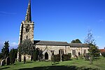
Situated off the A64 between Scarborough and Malton, close to the villages of Rillington and Wintringham.The village is agricultural and was once bigger than the small number of houses and farms which exist now. Enclosures were made in the 18th century and there were only 17 families in the village in 1843. Very agricultural, the village is now without a public house, school or Post Office. The last Post Office was run by Mrs Mary Grayson and her husband the postman Mr George Grayson. The school building still survives. The Royal Oak Inn has long gone.The church is that of All Saints. It has Norman architecture in part but is mainly a result of restoration in 1879–1880. There is a large Rectory Building, seemingly out of scale with the rest of the buildings, but built in 1860 as a typical Victorian semi-gentry home for the Rectors of the time.Many acres were bought by Sir George Chumley of Wintringham in the last century which added to the landholdings in nearby Wintringham and the estate is still owned by the family today.


