place

Atlit Yam

1984 archaeological discoveries7th-millennium BC establishmentsArchaeological sites in IsraelHistory of fishingMaritime archaeology in Israel
Megalithic monuments in the Middle EastNeolithic settlementsPopulated places established in the 7th millennium BCPre-Pottery Neolithic BPrehistoric sites in IsraelStone circles in AsiaUnderwater archaeological sites
Atlit Yam, Ritual structure made of stones

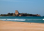
Atlit Yam is a submerged ancient Neolithic village off the coast of Atlit, Israel. It has been carbon-dated as to be between 8,900 and 8,300 years old. Among the features of the 10-acre (4.0 ha) site is a stone circle.

Excerpt from the Wikipedia article Atlit Yam (License: CC BY-SA 3.0, Authors, Images).

Atlit Yam
HaShahaf, Hof HaCarmel Regional Council

Geographical coordinates (GPS) Address External links Nearby Places
placeShow on map

Wikipedia: Atlit YamContinue reading on Wikipedia

Geographical coordinates (GPS)

Latitude Longitude
N 32.710827777778 ° E 34.93515 °
placeShow on map

Address

Atlit Yam

HaShahaf
Hof HaCarmel Regional Council
Haifa District, Israel
mapOpen on Google Maps

linkWikiData (Q2896085)
linkOpenStreetMap (2570064176)

Atlit Yam, Ritual structure made of stones
Share experience

Nearby Places

Château Pèlerin
Château Pèlerin

Château Pèlerin (Old French: Chastel Pelerin; Latin: Castrum Perigrinorum, lit. 'Pilgrim Castle'), also known as Atlit and Magdiel, is a Crusader fortress and fortified town located about 2 kilometres (1.2 mi) north of the modern Israeli town of Atlit on the northern coast of Israel, about 13 kilometres (8.1 mi) south of Haifa. The Knights Templar began building the fortress in 1218 during the Fifth Crusade. One of the major Crusader fortresses, it could support up to 4,000 troops in siege conditions. It became for a short time the headquarters of the Crusaders; according to Claude Reignier Conder its architecture "must have made ‘Athlit perhaps the finest town of the period in the country". It has been described as the "crowning example of Crusader military architecture", although T. E. Lawrence found it lacking in elegance and imagination in terms of military architecture, settling on massiveness instead. In early August 1291, three months after the Siege of Acre, the forces of Al-Ashraf Khalil conquered Atlit, which was at that point the last remaining Crusader outpost in Syria, thus permanently ending Crusader presence in the region.The fortress remained intact for several hundred years, until suffering damage in the Galilee earthquake of 1837. In the 14th century, it became home to a large concentration of Oirat Mongols. During early Ottoman rule, in the 16th century, it was recorded in tax registers as a port of call and a farm. Later, in the 19th century, it was a small fishing village under the influence of the local al-Madi family. It was depopulated of its Palestinian inhabitants in 1948. In modern times, the castle is part of the Atlit naval base, a training zone for Israeli Naval commandos.