place

St. Paul Episcopal Cathedral (Cincinnati)

1828 establishments in Ohio19th-century Episcopal church buildingsBuildings and structures demolished in 1937Churches completed in 1852Cincinnati stubs
Demolished churches in OhioEpiscopal cathedrals in OhioEpiscopal churches in CincinnatiEpiscopal churches in OhioFormer Episcopal church buildings in the United StatesOhio church stubsReligious organizations established in 1828Use mdy dates from December 2017
St. Paul Episcopal Cathedral (Cincinnati) 1912

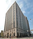
The St. Paul Episcopal Cathedral (1852) was located on the southeast corner of Seventh and Plum Streets, in Cincinnati, Ohio. The church was across from the Saint Peter in Chains Cathedral and next to the Plum Street Temple. The original St. Paul's Episcopal Church was located at 111 East Fourth Street. The congregation was formed in 1828 by the Rev. Samuel Johnson, pastor of Christ Church. He had been unable to collect two years of back pay. He won over a sizable portion of the flock to the new church. In 1883 the church merged with St. John's Episcopal Church at Seventh and Plum Streets, which had been formed by the Rev. Nicholson in 1851. The church became the cathedral of the Episcopal Diocese of Southern Ohio. One guidebook writes of the church, "For decades after the completion of this stately church in 1852, elegant and fashionable Cincinnatians worshiped there." The Rev. Nicholas Hamner Cobbs served this church for several years before becoming Bishop of Alabama. Salmon P. Chase was superintendent of the Sunday school. The building was demolished in 1937. Many of its members had moved to the suburbs. Today Christ Church Cathedral on Fourth Street is the seat of the Episcopal Diocese of Southern Ohio, and the chapel in the diocesan headquarters next door (which also houses the Forward Movement) is named after St. Paul.

Excerpt from the Wikipedia article St. Paul Episcopal Cathedral (Cincinnati) (License: CC BY-SA 3.0, Authors, Images).

St. Paul Episcopal Cathedral (Cincinnati)
West 7th Street, Cincinnati West End

Geographical coordinates (GPS) Address Website Nearby Places
placeShow on map

Wikipedia: St. Paul Episcopal Cathedral (Cincinnati)Continue reading on Wikipedia

Geographical coordinates (GPS)

Latitude Longitude
N 39.102777777778 ° E -84.518055555556 °
placeShow on map

Address

CyrusOne (7th Street Data Center)

West 7th Street 229
45202 Cincinnati, West End
Ohio, United States
mapOpen on Google Maps

Website
cyrusone.com

linkVisit website

St. Paul Episcopal Cathedral (Cincinnati) 1912
Share experience

Nearby Places

Cincinnati City Hall

Cincinnati City Hall is the seat of the municipal government of Cincinnati, Ohio. Completed in 1893, the Richardson Romanesque structure was listed in the National Register of Historic Places on December 11, 1972. The building was designed by Samuel Hannaford at a cost of $1.61 million. The main building comprises four and a half stories with a nine-story clock tower. The building was constructed by the David Hummel company of Cincinnati using stone quarried in Wisconsin, Ohio, Missouri, and Indiana. Marble stairways and wainscoting originated in Italy and Tennessee, while granite columns were obtained from Vermont. Stained glass windows were installed which depict Cincinnatus and illustrate Cincinnati's early history.The first city hall was built on this site in 1852 and was demolished in 1888 to make way for the current structure. Construction costs for the building totaled $1.61 million of which $54,000 was paid to Samuel Hannaford as architect and construction superintendent. "Cincinnati's City Hall represents the prevailing architectural tastes at the time of its construction and the influence of H. H. Richardson on its designer, Samuel Hannaford. Richardson's winning design for the Cincinnati Chamber of Commerce building was executed in the 1880s; however, the building's demolition in 1911 left City Hall the best remaining example of Richardson Romanesque in Cincinnati. Samuel Hannaford practiced from 1858 until 1897 and made a significant contribution to the architectural heritage of the Cincinnati area." An optical trick known as forced perspective makes the building appear even larger than it actually is. As it becomes taller, its windows get smaller.

Ninth Street Historic District

The Ninth Street Historic District is a group of historic buildings located along Ninth Street on the northern side of downtown Cincinnati, Ohio, United States. Composed of buildings constructed between the second quarter of the nineteenth century and the second quarter of the twentieth, it was primarily built between 1840 and 1890, when Cincinnati was experiencing its greatest period of growth. The district embraces the blocks of Ninth Street between Plum and Vine Streets, which includes forty-four buildings that contribute to the district's historic nature.Few Cincinnati streets retain such a cohesive collection of nineteenth-century architecture as do these three blocks of Ninth Street. Although the buildings were erected over a span of more than a century, they are remarkably similar in their construction: examples of the Queen Anne, Italianate, and Greek Revival styles of architecture are found in the district. Throughout the years that the district was constructed, Cincinnati was a city of pedestrians, and the diversity of the district's buildings highlight this status: within the district's boundaries can be found shops, houses, apartment buildings, and other commercial structures. Among the most important buildings in the district are the Abraham J. Friedlander House, the Brittany and Saxony Apartment Buildings, and the Phoenix Club, all of which were listed on the National Register of Historic Places between May 1979 and March 1980. Eighth months after the last of these four buildings was added to the National Register, the district itself was accorded a similar distinction.