Union Square (Salt Lake City)
Squares and plazas in Salt Lake City
.jpg)
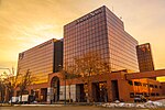
Union Square, also previously known as Public Square or University Square, is a historic block in Salt Lake City, Utah. Originally designated a public square during the initial 1847 survey of Salt Lake City, it was commonly used in the 1850s as a camping spot for recently arrived Mormon pioneers. As the city developed, the square became home to several educational institutions, including the University of Utah and has been home to West High School since 1901.
Excerpt from the Wikipedia article Union Square (Salt Lake City) (License: CC BY-SA 3.0, Authors, Images).Union Square (Salt Lake City)
300 West, Salt Lake City
Geographical coordinates (GPS) Address Nearby Places Show on map
 Continue reading on Wikipedia
 Geographical coordinates (GPS)
| Latitude | Longitude |
|---|---|
| N 40.774877777778 ° | E -111.90110277778 ° |
Address
West High School
300 West
84180 Salt Lake City
Utah, United States
Open on Google Maps