place

Kráľov Brod

Trnava Region geography stubsVillages and municipalities in Galanta District
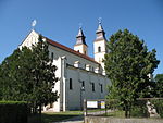
Királyrév templom kereszt 2

Kráľov Brod (Hungarian: Királyrév) is a village and municipality in Galanta District of the Trnava Region of south-west Slovakia.

Excerpt from the Wikipedia article Kráľov Brod (License: CC BY-SA 3.0, Authors, Images).

Geographical coordinates (GPS)

Latitude Longitude
N 48.06 ° E 17.826944444444 °
placeShow on map

Address

561
925 41 (Kráľov Brod)
Region of Trnava, Slovakia
mapOpen on Google Maps

Királyrév templom kereszt 2
Share experience

Nearby Places

Battle of Pered
Battle of Pered

The Battle of Pered, fought on 20–21 June 1849, was one of the battles which took place in the Summer Campaign of the Hungarian War of Independence from 1848 to 1849, fought between the Hungarian Revolutionary Army and the Habsburg Empire helped by Russian troops. The Hungarian army was led by General Artúr Görgei, while the imperial army by Lieutenant field marshal Julius Jacob von Haynau. After several preliminary minor battles of the Hungarian and Austrian troops along the Vág river, in which the attacking Hungarians could not achieve success, Görgei took the command of his troops, and after receiving reinforcements, on 20 June, put his troops to attack again towards West. Although the II. Hungarian army corps occupied in heavy fights the village of Pered, the other two corps (the III. and the VIII.) were unsuccessful, and could not advance. The angered Görgei removed the commander of the III. corps, General Károly Knezić because of his inactivity, and Colonel Lajos Asbóth, the commander of the II. corps who, in contrast to Knezić, was the only commander who accomplished his duties. While Knezić's place was taken by Colonel Károly Leiningen-Westerburg, who was a great choice, Asbóth's place was taken by Colonel József Kászonyi, who was an explicitly bad choice. Haynau, who on the first day of the battle was moving the bulk of his troops to cross the Danube to start an attack on its southern bank, sent three of his corps, which were still on the northern bank, to repel the Hungarian forces. The two Austrian (II., IV.) and one Russian (Fedor Panyutin's) corps started their attack on 21 June and forced the Hungarians to retreat from Pered and Zsigárd, which forced Görgei to order his troops to retreat from the battlefield.

Danubian Flat
Danubian Flat

The Danubian Flat (Slovak and Czech: Podunajská rovina, German: Donauebene), also translated as Danubian Plain, is the south-western, flatter, part of the Danubian Lowland in Slovakia. The border with the Danubian Hills runs approx. along the line Bratislava – Senec – Sereď – Nové Zámky – Patince. It has been formed by the arms of the Danube (Little Danube and others) and by the southern Váh, Nitra and Žitava rivers. It is filled with huge layers of gravel from the Danube and other rivers of the area. These Danubian gravels are covered with loess and other very fertile soils. The Danube forms here a unique continental delta system of meanders and dead arms. The area between one of those arms called Little Danube and the Danube is known as the Žitný ostrov, the biggest river island in Europe. The Žitný ostrov is an area with marsh depressions, natural lakes and artificial lakes. The drainage system of the southern area was (deliberately) significantly changed by the construction of the Gabčíkovo Dam on the Danube. The Žitný ostrov has been a "Protected Water Management Area" since 1978. The area is rich in forest glades, water and marsh fauna and flora. It has rich subterranean water reservoirs. Those in Žitný ostrov are among the largest in Central Europe. Warm springs can be found in Komárno, Štúrovo and Patince. The area has the warmest and driest climate in Slovakia. This, and the fact that it has fertile soils, make it the ideal place for agriculture. Wheat, sugar beets, sweet corn, vegetables and tobacco are grown here. Fruit and vine growing are also important. The most important towns of the area are the Slovak capital Bratislava (the Danube Flat begins in below Bratislava Castle in central Bratislava), Galanta, Sereď, Dunajská Streda, Komárno, and Nové Zámky. The area features many small-scale protected areas, such as Ostov Kopáč in Bratislava or the Vlčianske mŕtve rameno, Čičovské mŕtve rameno. Protected marshes are for example the unique Šúr area in Svätý Jur. The area of Zlatná na Ostrove provides an extensive habitat for great bustards. Excellent opportunities for summer recreation are provided by the lakes Zlaté piesky in Bratislava and the lakes Slnečné jazerá in Senec, or by thermal swimming pools in Dunajská Streda, Veľký Meder and Diakovce.