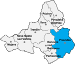
Uhrovské Podhradie
Trenčín geography stubsVillages and municipalities in Bánovce nad Bebravou District

Uhrovské Podhradie (Hungarian: Zayváralja) is a village and municipality in Bánovce nad Bebravou District in the Trenčín Region of north-western Slovakia. The village is situated close to the ruins of a Roman castle Uhrovec.
Excerpt from the Wikipedia article Uhrovské Podhradie (License: CC BY-SA 3.0, Authors, Images).Uhrovské Podhradie
Geographical coordinates (GPS) Address Nearby Places Show on map
Geographical coordinates (GPS)
| Latitude | Longitude |
|---|---|
| N 48.766666666667 ° | E 18.383333333333 ° |
Address
73
956 41
Region of Trenčín, Slovakia
Open on Google Maps


