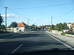
Chynorany
Trenčín geography stubsVillages and municipalities in Partizánske District

Chynorany (Hungarian: Kinorány) is a village and municipality in Partizánske District in the Trenčín Region of western Slovakia.The village is located on the right bank of the river Nitra, approximately in the middle between the towns of Partizánske and Topoľčany. Northwest the terrain curves into the Bojice hillside, following the mountain range of Považský Inovec. To the south and east, behind the river Nitra, rises the mountain range of Tribeč. Partizánske is 10 km northeast, Topoľčany 12 km southwest and Bánovce nad Bebravou 15 km north from Chynorany.
Excerpt from the Wikipedia article Chynorany (License: CC BY-SA 3.0, Authors, Images).Chynorany
Sládkovičova,
Geographical coordinates (GPS) Address Nearby Places Show on map
Geographical coordinates (GPS)
| Latitude | Longitude |
|---|---|
| N 48.608333333333 ° | E 18.266666666667 ° |
Address
Sládkovičova 1453/17
956 33 (Chynorany)
Region of Trenčín, Slovakia
Open on Google Maps


