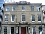
place

Orthodox Church in America Archdiocese of Pittsburgh and Western Pennsylvania

Dioceses of the Orthodox Church in AmericaEastern Orthodoxy in OhioEastern Orthodoxy in PennsylvaniaEastern Orthodoxy in West Virginia
Map of USA highlighting OCA Diocese of Western Pennsylvania

The Archdiocese of Pittsburgh and Western Pennsylvania is a diocese of the Orthodox Church in America (OCA). Its territory includes parishes, monasteries, and missions located in three states in the United States – Pennsylvania, Ohio, and the entirety of West Virginia. The diocesan chancery is located in Cranberry Township, Pennsylvania. The current bishop of Pittsburgh and Western Pennsylvania, Melchisedek (Pleska), was enthroned on June 27, 2009. The previous Archbishop of Pittsburgh and Western Pennsylvania, Kyrill (Yonchev), died on June 17, 2007.

Excerpt from the Wikipedia article Orthodox Church in America Archdiocese of Pittsburgh and Western Pennsylvania (License: CC BY-SA 3.0, Authors, Images).

Orthodox Church in America Archdiocese of Pittsburgh and Western Pennsylvania
Boulevard of the Allies, Pittsburgh

Geographical coordinates (GPS) Address Website Nearby Places
placeShow on map

Wikipedia: Orthodox Church in America Archdiocese of Pittsburgh and Western PennsylvaniaContinue reading on Wikipedia

Geographical coordinates (GPS)

Latitude Longitude
N 40.439465 ° E -80.004321 °
placeShow on map

Address

Diocese of Pittsburgh

Boulevard of the Allies 111
15222 Pittsburgh
Pennsylvania, United States
mapOpen on Google Maps

Website
diopitt.org

linkVisit website

Map of USA highlighting OCA Diocese of Western Pennsylvania
Share experience

Nearby Places

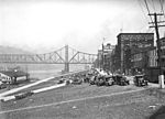
Boulevard of the Allies

The Boulevard of the Allies is a mostly four-lane road in the U.S. state of Pennsylvania, connecting Downtown Pittsburgh with the Oakland neighborhood of the city. Because of its lengthy name, locals sometimes refer to it as simply "The Boulevard". Some sections are part of Pennsylvania Route 885. The road begins in Downtown Pittsburgh at its intersection with Commonwealth Place and an offramp from Interstate 279. The road continues east through Downtown passing Point Park University and the former Art Institute of Pittsburgh building to Grant Street where it becomes elevated to transition from the flat plain of Downtown to the bluff that Oakland sits on. Before reaching Oakland, it passes by Duquesne University and Mercy Hospital along the edge of a cliff several hundred feet above the Monongahela River with views of the city's South Side neighborhood and includes partial interchanges with Interstate 579 and Interstate 376. At its interchange with I-579, the road is split; westbound traffic must exit from the road onto I-579 or the Liberty Bridge. The second westbound portion of Boulevard of the Allies is only accessible via an entrance ramp from the Liberty Bridge. Upon reaching Oakland, it cuts through the southern portion of the neighborhood and leads into Schenley Park just bypassing the University of Pittsburgh and Carnegie Mellon University. Upon entering the park across the Anderson Bridge, the road's name changes to Panther Hollow Road (named after Panther Hollow) and continues through the park to become Hobart Street in the Squirrel Hill neighborhood east of Schenley Park. The road is named in honor of the Allies of World War I. The Boulevard of the Allies was rededicated on June 29, 2008 as part of the celebration of Pittsburgh's 250th anniversary. As part of the rededication, American flags have been added on both sides of the boulevard as it elevates toward the Liberty Bridge ramp and thirty temporary banners celebrating the Allies of World War I have been affixed, following the road to its end.