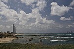
Caesarea Maritima

Caesarea (; Greek: Καισάρεια Kaisáreia, Hebrew: קיסריה Keisaria, Arabic: قيسارية Qisarya), also Caesarea Maritima, Caesarea Palaestinae or Caesarea Stratonis, While the name Caesarea was frequently used alone, various suffixes were also used to disambiguate it from the other cities in the Roman Empire that were also known as Caesarea. Caesarea-Palaestinae was the most common of these in the ancient texts, but fell out of use in contemporary academic literature in favor of Caesarea Maritima. was an ancient and medieval city in the Sharon plain on the coast of the Eastern Mediterranean, and later a small fishing village. It was the capital of Roman Judaea, Syria Palaestina and Palaestina Prima, successively, for a period of c.650 years, and a major intellectual hub of the Mediterranean, from the time of Herod I until the Muslim conquest of the Levant. Today, the site is an Israeli national park and its ruins are part of the Caesarea National Park. The site was first settled in the 4th century BCE as a Phoenician colony and trading village known as Straton's Tower after the ruler of Sidon. It was enlarged in the 1st century BCE under Hasmonean rule, becoming a Jewish village, and in 63 BCE, when the Roman Republic annexed the region, it was declared an autonomous city. It was then significantly enlarged in the Roman period by the Judaean client king Herod I, who established a new harbour and dedicated the town and its port to Caesar Augustus as Caesarea. During the early Roman period, Caesarea became the seat of the Roman procurators in the region. The city was populated throughout the 1st to 6th centuries CE and became an important early centre of Christianity during the Byzantine period. Its importance may have waned starting during the Muslim conquest of 640 in the early Middle Ages. After being re-fortified by Muslim rulers in the 11th century, it was conquered by the Crusaders, who strengthened and made it into an important port, and was finally slighted by the Mamluks in 1265. The Latin name Caesarea was adopted into Arabic as Qisarya قيسارية, a small fishing village on the ancient site. In the 1948 Palestine war its population fled ahead of or were expelled by the Zionist militant group Lehi and its houses demolished. The ruins of the ancient city beneath the depopulated village were excavated in the 1950s and 1960s for archaelogical purposes, and in 1977, the site was incorporated into the modern municipality of Caesarea.
Excerpt from the Wikipedia article Caesarea Maritima (License: CC BY-SA 3.0, Authors, Images).Caesarea Maritima
6511, Hof HaCarmel Regional Council
Geographical coordinates (GPS) Address Nearby Places Show on map
Geographical coordinates (GPS)
| Latitude | Longitude |
|---|---|
| N 32.5 ° | E 34.891666666667 ° |
Address
6511
3056502 Hof HaCarmel Regional Council
Haifa District, Israel
Open on Google Maps


