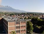
Gerlachovský štít (Slovak pronunciation , translated into English as Gerlachov Peak, German: Gerlsdorfer Spitze, Hungarian: Gerlachfalvi-csúcs), informally referred to as Gerlach, is the highest peak in the High Tatras, in Slovakia, and in the Carpathian Mountains. Its elevation is usually listed at 2654.4 m above mean sea level. The pyramidal shape of the massif is marked by a huge cirque. Despite its relatively low elevation, Gerlachovský štít features a vertical rise of approximately 2,000 metres (6,600 ft) above the valley floor.Mistaken for an average mountain in the rugged High Tatras range in the more distant past, it has since played a symbolic role in the eyes of the rulers and populations of several Central European nations, to the point that between the 19th and mid-20th century, it had four different names with six name reversals. Due to geopolitical changes, it managed to be the highest mountain of the Kingdom of Hungary, and of Czechoslovakia, Slovakia and then Czechoslovakia again within the span of less than three decades of the 20th century.
Gerlachovský štít shares its geology and ecology with the rest of the High Tatras, but provides a worthwhile environment for biologists as the highest ground anywhere in Europe north of the parallel approximately linking Munich, Salzburg, and Vienna. With the travel restrictions imposed by the Eastern Bloc, the mountain was particularly treasured by Czechs, East Germans, Hungarians, Poles, and Slovaks as the loftiest point available for them to climb. Although local authorities have since restricted access to the peak, it continues to attract its share of visitors.


