place

Gartocharn

Pages with Scottish Gaelic IPAUse British English from September 2019Villages in West Dunbartonshire
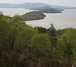
View over Gartocharn to Duncryne Hill

Gartocharn (; Scottish Gaelic: Gart a’ Chàirn [ˈkarˠʃt̪ ə ˈxaːrˠɲ]) is a village in West Dunbartonshire in Scotland, United Kingdom. It is the only village in the parish of Kilmaronock (not to be confused with the town of Kilmarnock in East Ayrshire). The parish has a population of c. 680.It lies on the A811, the main road from Balloch to Stirling. It is close to the shore of Loch Lomond, and to Ross Priory. It is dominated by a nearby hill, Duncryne, also known as the Kilmaronock Dumpling. The village has two churches, a primary school, convenience shop and garage. There is a weekly fruit and vegetable market held at France Farm. The former Gartocharn Hotel is now closed The local bi-monthly magazine is known as the ‘Gartorag’. Historically, the village's economy was based on agriculture, being surrounded by many large farms and estates. In recent years, this has dwindled, however, there is still a large haulage firm, Coopers, and the Lochs and Glens holiday company based in the village. Sir Walter Scott is reputed to have written Lady of the Lake whilst staying at Ross Priory and Gartochraggan, on the waters edge, north of the village. In the 1870s and 1880s, the village had a football side, Kilmaronock Thistle F.C., which played in the Scottish Cup.

Excerpt from the Wikipedia article Gartocharn (License: CC BY-SA 3.0, Authors, Images).

Gartocharn
Old Military Road,

Geographical coordinates (GPS) Address Nearby Places
placeShow on map

Wikipedia: GartocharnContinue reading on Wikipedia

Geographical coordinates (GPS)

Latitude Longitude
N 56.0419 ° E -4.5274 °
placeShow on map

Address

Old Military Road

Old Military Road
G83 8RX
Scotland, United Kingdom
mapOpen on Google Maps

View over Gartocharn to Duncryne Hill
Share experience

Nearby Places

Loch Lomond National Nature Reserve

Loch Lomond National Nature Reserve (NNR) (Scottish Gaelic: Tèarmann Nàdair Nàiseanta Loch Laomainn) encompasses 430 hectares of land at the southeastern part of Loch Lomond in the council areas of Stirling and West Dunbartonshire, in Scotland. It covers the islands of Inchcailloch, Clairinsh, Torrinch, Creinch and Aber Isle, alongside areas of woodland and wetlands to either side of the mouth of the Endrick Water. NatureScot owns two parts of the reserve - the island of Inchcailloch and part of Gartfairn Wood - and the rest is privately owned. The reserve is managed by a partnership consisting of NatureScot, the RSPB Scotland and the Loch Lomond and The Trossachs National Park, along with the owners and tenants of the land under agreements. Within this framework NatureScot directly manage the islands of Clairinsh, Inchcailloch, Torrinch and Creinch, and land to the north of the Endrick Water. The RSPB manages the area to the south of the Endrick Water, and the national park manages visitor facilities on Inchcailloch.The first part of Loch Lomond to be declared a national nature reserve was Clairinsh in 1958; the reserve was subsequently extended three times to reach its present size. The reserve encompasses a wide range of habitats, including woodlands, open water, grassland and wetlands. Due to its position on the Highland Boundary Fault, the varying natural environments of the highlands and lowlands give rise to habitats and species at both their northern and southern limit. Prior to becoming an NNR, the land was used for farming, producing woodland and to a lesser degree, for recreation. Some of these practices are still used, but now with a stronger focus on wildlife practices and maintaining the diversity of the area.