Boley Park
Areas of LichfieldUse British English from October 2014

Boley Park is the name given to the ward and suburb of Lichfield in the Lichfield District and the county of Staffordshire, England. It is one of the six wards on Lichfield City Council and as of September 2024 was represented by Cllrs Andrew Fox (Con), Janet Eagland (Lab), Mark Warfield (Con) and Robert Yardley. (Con).
Excerpt from the Wikipedia article Boley Park (License: CC BY-SA 3.0, Authors, Images).Boley Park
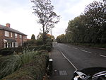
Ryknild Street, Lichfield Boley Park
Geographical coordinates (GPS) Address Nearby Places Show on map
Geographical coordinates (GPS)
| Latitude | Longitude |
|---|---|
| N 52.680671 ° | E -1.805249 ° |
Address
Ryknild Street
WS14 9XP Lichfield, Boley Park
England, United Kingdom
Open on Google Maps


