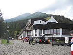
Slavkovský štít
High TatrasMountains of SlovakiaMountains of the Western Carpathians

Slavkovský štít is the fourth highest mountain peak that can be reached on a marked trail in the High Tatra mountains in Slovakia. Its summit is 2452 metres above sea level. It can be reached by foot on a walking trail in about four and a half hours from Starý Smokovec. The first recorded ascent was by Juraj Buchholtz in 1664 and it took the group of 12 members 2 days, while only 4 of them reached the summit.In 19th century it was considered to build Observatory and Meteorological Station on the summit together with a lift going up from Starý Smokovec. The project turned out to be technically unrealistic.
Excerpt from the Wikipedia article Slavkovský štít (License: CC BY-SA 3.0, Authors, Images).Slavkovský štít
Na Pyšný štít,
Geographical coordinates (GPS) Address External links Nearby Places Show on map
Geographical coordinates (GPS)
| Latitude | Longitude |
|---|---|
| N 49.166111111111 ° | E 20.184722222222 ° |
Address
Slavkovský štít
Na Pyšný štít
062 01 (Tatranská Lomnica)
Region of Prešov, Slovakia
Open on Google Maps


