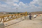
Khirbet Jamjum
Ancient Jewish settlements of JudaeaArchaeological sites in the West BankHasmonean KingdomHasmonean dynastyJews and Judaism in the Roman Republic and the Roman Empire

Khirbet Jamjum is an archeological site located at the western part of Gush Etzion, in the West Bank. It is situated on top of a high hill with cliff walls surrounding on three of its sides. The site was surveyed in the 1990s and excavated in 2005 and 2008.
Excerpt from the Wikipedia article Khirbet Jamjum (License: CC BY-SA 3.0, Authors, Images).Khirbet Jamjum
עין לבנה, Beitar Ilit
Geographical coordinates (GPS) Address Nearby Places Show on map
Geographical coordinates (GPS)
| Latitude | Longitude |
|---|---|
| N 31.667472222222 ° | E 35.088111111111 ° |
Address
עין לבנה
עין לבנה
Beitar Ilit
Judea and Samaria, Palestinian Territories
Open on Google Maps


