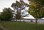
Leelanau Peninsula
The Leelanau Peninsula ( LEE-lə-naw) is a peninsula of the U.S. state of Michigan that extends about 30 miles (50 km) from the western side of the Lower Peninsula of Michigan into Lake Michigan, forming Grand Traverse Bay. It is often referred to as the "little finger" of the mitten-shaped lower peninsula. The peninsula is a tourist hotspot, especially due to the popularity of Sleeping Bear Dunes National Lakeshore, which adorns the southwestern coast of the peninsula. The peninsula is also largely agricultural, and is a production hotspot for cherries and wine.Most of the peninsula is politically part of the eponymous Leelanau County, which also administers the nearby Manitou Islands and Fox Islands. The base of the peninsula, at its southern end, is divided between Benzie County and Grand Traverse County. Traverse City, the largest city in Northern Michigan, is located at the southeastern end of the peninsula, at the head of Grand Traverse Bay.
Excerpt from the Wikipedia article Leelanau Peninsula (License: CC BY-SA 3.0, Authors).Leelanau Peninsula
East Kolarik Road, Leelanau Township
Geographical coordinates (GPS) Address Nearby Places Show on map
Geographical coordinates (GPS)
| Latitude | Longitude |
|---|---|
| N 45.05 ° | E -85.655 ° |
Address
East Kolarik Road
East Kolarik Road
Leelanau Township
Michigan, United States
Open on Google Maps


