place

Scrivener Dam

Buildings and structures in CanberraDams completed in 1963Dams in the Australian Capital TerritoryGravity damsMurray-Darling basin
Use Australian English from February 2013
Scrivener Dam Lightened

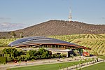
Scrivener Dam is a concrete gravity dam that impounds the Molonglo River in Canberra, Australian Capital Territory. The dam creates Lake Burley Griffin, which was established for recreational and ornamental purposes. Named in honour of surveyor Charles Scrivener, the dam was officially inaugurated on 20 September 1963 (1963-09-20) and the official filling of the lake commemorated on 17 October 1964 (1964-10-17) by the Prime Minister, Robert Menzies. The dam wall is located on Lady Denman Drive and is adjacent to the National Zoo & Aquarium and a viewing area for the official residence of the Governor-General of Australia.

Excerpt from the Wikipedia article Scrivener Dam (License: CC BY-SA 3.0, Authors, Images).

Scrivener Dam
Lady Denman Drive, Canberra Yarralumla

Geographical coordinates (GPS) Address Nearby Places
placeShow on map

Wikipedia: Scrivener DamContinue reading on Wikipedia

Geographical coordinates (GPS)

Latitude Longitude
N -35.299722222222 ° E 149.07222222222 °
placeShow on map

Address

Lady Denman Drive

Lady Denman Drive
2600 Canberra, Yarralumla
Australia
mapOpen on Google Maps

Scrivener Dam Lightened
Share experience

Nearby Places

Yarralumla brickworks

The Yarralumla brickworks, also known as the Commonwealth Brickworks, was one of the earliest construction projects in Canberra, Australia. It was built in the suburb of Yarralumla to produce the bricks used to build many of Canberra's early buildings. It opened in around 1913 and operated until its closure in 1976. It is known for producing the bricks used to build itself. Narrow gauge goods railway lines for the transportation of bricks linked Yarralumla to some of the major building sites in central Canberra such as Old Parliament House, and the Kingston Power House. No sign of this early Canberra transport system remains today. The original brick kilns were built according to Walter Burley Griffin's designs with fan forced short chimneys intended to stay below the height of the surrounding pine trees. In 1950 after World War II increased building demands in Canberra meant that a large 46 metre natural-draft chimney was built for the new kilns. This greatly increased brick production capacity. The tall chimney is visible from many locations around central Canberra. In recent years a report found that the tall chimney was not earthquake-safe. As the chimney was heritage listed and located within falling distance of nearby homes, an engineering firm was called in to make it safe. A frame was built inside the chimney to support it without affecting its external appearance. The brickworks today is closed to the public but has had various uses over the past 20 years. There have been several recent ideas that haven't eventuated, including using the site for Canberra's new gaol, making the site the new permanent home for Floriade (a yearly Canberra flower festival) or to turn the brickworks into a holiday resort. Future plans for the site are still undecided. As of February 2015 it was proposed that a housing estate could be constructed on the site, consisting of 1800 dwellings.

Curtin, Australian Capital Territory

Curtin () is a suburb in Canberra, Australia, part of the Woden Valley district; its postcode is 2605. Curtin is named after John Curtin, Australian Prime Minister between 1941 and 1945. Its streets are named after state premiers.It is next to the suburbs of Yarralumla, Deakin, Hughes, Lyons and Weston. It is bounded by the Cotter Road, Tuggeranong Parkway, Yarra Glen and a green strip between it and Lyons to the south. Curtin shopping centre offers the following services: Coles supermarket, post office, newsagent, bank, real estate agent, chemist, hairdresser, barber, travel agent, optometrist, florist, bakery, greengrocer and numerous cafes and coffee shops. Of note is the Curtin Milk Bar which was the longest running cafe in the area. Its style and operation remained unchanged since the 1970s until its closure in December 2017. Nearby is Curtin Scout Hall. Areas of Curtin were designed in accordance with the Radburn model of suburban design and public housing. In Australia, the Radburn model was used in the planning of some Canberra suburbs developed in the 1960s, in particular Charnwood, Curtin and Garran, and a small part of Hughes. These pockets of Radburn design have not seen the same anti-social and crime-related problems that have plagued similar areas in Western and South-Western Sydney, such as Mt Druitt. The Canberra bushfires of 2003 destroyed four Curtin homes and caused damage to others. The Emergency Services Bureau, based in Curtin, which was the centre of command for the firefighting operation, came under threat itself when its roof caught fire. The suburb celebrated the fiftieth anniversary of the arrival of its first residents in 2014. As part of that celebration, the Canberra & District Historical Society, which is headquartered at the shops, helped local residents to record oral histories of their memories. They can be accessed on a Web site called Curtin Living Memories. Residents subsequently compiled and published a book on life in the suburb called, Curtin Turns 50.