Ortigosa, Portugal
Centro Region, PortugalFormer parishes of PortugalLeiria geography stubsPopulated places in Leiria DistrictVillages in Portugal
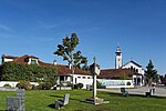
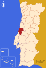
Ortigosa is a Portuguese village and former civil parish located in the municipality of Leiria, with an area of 12.86 km2 (4.97 sq mi) and 1971 inhabitants in 2011. In 2013 the parish merged into the new parish Souto da Carpalhosa e Ortigosa. Its patron is Santo Amaro.
Excerpt from the Wikipedia article Ortigosa, Portugal (License: CC BY-SA 3.0, Authors).Ortigosa, Portugal
Rua da Lameira, Leiria
Geographical coordinates (GPS) Address Nearby Places Show on map
Geographical coordinates (GPS)
| Latitude | Longitude |
|---|---|
| N 39.8242972632 ° | E -8.8318610099327 ° |
Address
Rua da Lameira
Rua da Lameira
2425-737 Leiria (Souto da Carpalhosa e Ortigosa)
Portugal
Open on Google Maps


