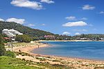
Brisbane Water is a wave-dominated barrier estuary located in the Central Coast region, north of Sydney, New South Wales, Australia. Brisbane Water has its origin at the confluence of the Narara and Coorumbine Creeks, to the south–east of Gosford and travels for approximately 18 kilometres (11 mi) in a southerly direction to its mouth at Broken Bay, about 7 kilometres (4.3 mi) from the Tasman Sea, at Barrenjoey Head. A number of towns and suburbs surround the shores of Brisbane Water, including Blackwall, Booker Bay, Davistown, Empire Bay, Erina, Ettalong Beach, Gosford, Green Point, Hardys Bay, Kilcare, Kincumber, Koolewong, Phegans Bay, Point Frederick, Point Clare , Saratoga, Tascott, Wagstaffe, and Woy Woy. Contained within Brisbane Water is St Huberts Island, Rileys Island, Dunmar Island and Pelican Island; and adjoining the estuary is Brisbane Water National Park to the west and Bouddi National Park to the east. Forming part of the same tidal estuary system is a separate but connected basin, the Kincumber Broadwater, lying to the east of Davistown.
The total catchment area of the river is approximately 165 square kilometres (64 sq mi).
The land adjacent to the Brisbane Water was occupied for many thousands of years by Australian Aboriginal peoples, the Darkinjung and Kuringgai, who used the estuary and foreshore areas for cultural purposes.Brisbane Water was named in 1825 in honour of Sir Thomas Brisbane, a Governor of New South Wales, serving between 1820 and 1825.


